
IMAGES TAKEN NEAR TO
West Lorimer Place, PRESTONPANS, EH32 0JF
Introduction
This page details the photographs taken nearby to West Lorimer Place, EH32 0JF by members of the Geograph project.
The Geograph project started in 2005 with the aim of publishing, organising and preserving representative images for every square kilometre of Great Britain, Ireland and the Isle of Man.

There are currently over 7.5m images from over14,400 individuals and you can help contribute to the project by visiting https://www.geograph.org.uk
Image Map
Images are licensed for reuse under creativecommons.org/licenses/by-sa/2.0
Notes
- Clicking on the map will re-center to the selected point.
- The higher the marker number, the further away the image location is from the centre of the postcode.
Image Listing (693 Images Found)
Images are licensed for reuse under creativecommons.org/licenses/by-sa/2.0
Image
Details
Distance
1

Cockenzie House
Flowers bordering the War Memorial. The house was at the time a nursing home. Its future is now uncertain.
Image: © Richard Webb
Taken: 28 Apr 2006
0.01 miles
2

Cockenzie and Port Seton war memorial
In a well kept park.
Image: © Richard Webb
Taken: 28 Apr 2006
0.01 miles


5

Telephone box, Lorimer Place
The telephone has now gone, the box is sure to follow.
Image: © Richard Webb
Taken: 6 Jun 2010
0.03 miles

7

Site of telephone box, Lorimer Place
There is not a trace of the telephone box that recently stood here. It was removed sometime in Summer 2010. Image
Image: © Richard Webb
Taken: 8 Sep 2010
0.05 miles
8

West Lorimer Place
End of West Lorimer Place, with some newer houses in the background.
Image: © Richard Webb
Taken: 15 Dec 2008
0.05 miles

10
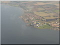
Cockenzie and Port Seton
Looking eastwards from over the Firth of Forth, with the power station prominent in the foreground and Longniddry and Seton Sands in the distance.
Power generation at the coal-fired power station ceased at 0834 on 15 March 2013. When built in 1967 it cost £50 million and produced enough power for 1 million homes. It is possible that it may be converted in the future to use gas.
Image: © M J Richardson
Taken: 7 Oct 2010
0.05 miles