
IMAGES TAKEN NEAR TO
Farquhar Terrace, SOUTH QUEENSFERRY, EH30 9RW
Introduction
This page details the photographs taken nearby to Farquhar Terrace, EH30 9RW by members of the Geograph project.
The Geograph project started in 2005 with the aim of publishing, organising and preserving representative images for every square kilometre of Great Britain, Ireland and the Isle of Man.

There are currently over 7.5m images from over14,400 individuals and you can help contribute to the project by visiting https://www.geograph.org.uk
Image Map
Images are licensed for reuse under creativecommons.org/licenses/by-sa/2.0
Notes
- Clicking on the map will re-center to the selected point.
- The higher the marker number, the further away the image location is from the centre of the postcode.
Image Listing (156 Images Found)
Images are licensed for reuse under creativecommons.org/licenses/by-sa/2.0
Image
Details
Distance
1

Chimneys, Hopetoun Road
Looking down from the Approach Viaduct to the Forth Road Bridge - oddly varied on the left side and uniform on the right. The park behind is King George V Park, on Society Road.
Image: © M J Richardson
Taken: 30 Nov 2014
0.01 miles

3

Old and new bridges across the Forth
The new bridge is taking shape as the bridge decks grow outwards from the three towers, seen from the cyclepath on the suspension bridge. Hopetoun Road in South Queensferry is below.
Image: © Jim Barton
Taken: 12 Jun 2016
0.03 miles
4

Hopetoun Road
Hopetoun Road in South Queensferry, taken from the road bridge.
Image: © Robert Struthers
Taken: 12 Jan 2013
0.03 miles
5

Hopetoun Road, South Queensferry
Seen from the southern approach to the Forth Road Bridge.
Image: © John Allan
Taken: 2 Jul 2017
0.03 miles
6
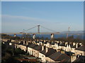
Hopetoun Road, Queensferry
Looking across the roof tops from the approach viaduct to the Forth Road Bridge. The structure beyond is the approach viaduct to The Queensferry Crossing, as it heads towards the southernmost tower. To the right of the vertical support is Dumyat [35km], and to the left Ben Ledi[68km] - a brilliantly clear morning.
Image: © M J Richardson
Taken: 30 Nov 2014
0.04 miles
7

Tree-clad area near the Forth Road Bridge
Image: © Gordon Brown
Taken: 21 Jul 2019
0.05 miles
8

Hopetoun Road, Queensferry
Municipal housing and speed bumps on the road out to Hopetoun House.
Image: © Richard Webb
Taken: 21 Jul 2006
0.07 miles

10

Under the Forth Road Bridge at South Queensferry
The cleared area under the bridge at this point appears to be a boat park.
Image: © Douglas Nelson
Taken: 3 Mar 2016
0.08 miles