
IMAGES TAKEN NEAR TO
Moubray Grove, SOUTH QUEENSFERRY, EH30 9PE
Introduction
This page details the photographs taken nearby to Moubray Grove, EH30 9PE by members of the Geograph project.
The Geograph project started in 2005 with the aim of publishing, organising and preserving representative images for every square kilometre of Great Britain, Ireland and the Isle of Man.

There are currently over 7.5m images from over14,400 individuals and you can help contribute to the project by visiting https://www.geograph.org.uk
Image Map
Images are licensed for reuse under creativecommons.org/licenses/by-sa/2.0
Notes
- Clicking on the map will re-center to the selected point.
- The higher the marker number, the further away the image location is from the centre of the postcode.
Image Listing (7 Images Found)
Images are licensed for reuse under creativecommons.org/licenses/by-sa/2.0
Image
Details
Distance
1
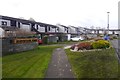
Scotstoun Park, Queensferry
A plaque says that it won an award in 1970. The grass had recently been treated with lawnsand.
Image: © Richard Webb
Taken: 9 Mar 2020
0.05 miles
2
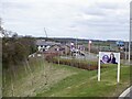
Brigger's Brae
New houses between the A90 and Queensferry.
Image: © Richard Webb
Taken: 25 Apr 2023
0.21 miles
3

The Queensferry Crossing Southern Approach Road
Image: © Graeme Yuill
Taken: 26 Jun 2016
0.23 miles
4
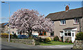
Flowering Tree
A tree in a garden is laden with blossom; I think it's a cherry of some kind.
Image: © Anne Burgess
Taken: 1 Apr 2012
0.23 miles
5

Cherry Blossom
A real harbinger of spring, this is a closer view of the blossom in Image
Image: © Anne Burgess
Taken: 1 Apr 2012
0.23 miles
6

Field and oaks at Queensferry
Looking at the map, the oaks are presumably the surviving standards from an original hedge that has disappeared. The A90 just after it has acquired the M9 traffic is at the other end of the field.
Image: © M J Richardson
Taken: 16 May 2009
0.24 miles
7

South Queensferry : Roadworks
Roadworks seen alongside the A90 in South Queensferry.
Image: © Lewis Clarke
Taken: 22 Apr 2016
0.25 miles