
IMAGES TAKEN NEAR TO
Hallcroft Crescent, NEWBRIDGE, EH28 8SB
Introduction
This page details the photographs taken nearby to Hallcroft Crescent, EH28 8SB by members of the Geograph project.
The Geograph project started in 2005 with the aim of publishing, organising and preserving representative images for every square kilometre of Great Britain, Ireland and the Isle of Man.

There are currently over 7.5m images from over14,400 individuals and you can help contribute to the project by visiting https://www.geograph.org.uk
Image Map
Images are licensed for reuse under creativecommons.org/licenses/by-sa/2.0
Notes
- Clicking on the map will re-center to the selected point.
- The higher the marker number, the further away the image location is from the centre of the postcode.
Image Listing (32 Images Found)
Images are licensed for reuse under creativecommons.org/licenses/by-sa/2.0
Image
Details
Distance
1

Canal Obstruction
At several points along the Union Canal there are fallen trees in the water, partly obstructing the waterway.
Image: © Anne Burgess
Taken: 15 Feb 2012
0.03 miles
2

Canal Obstruction
This is the same fallen tree as in Image A patch of debris and scum has gathered where the water flow is impeded.
Image: © Anne Burgess
Taken: 15 Feb 2012
0.03 miles
3

Long and curving wall
Stone wall along a stretch of Union canal.
Image: © Jim Smillie
Taken: 2 Apr 2009
0.05 miles
4

Hanging on
Snails on wall beside Union Canal.
Image: © Jim Smillie
Taken: 2 Apr 2009
0.05 miles
5

Walkers on Union Canal
Two people take the canal path towards the Edinburgh International Climbing Arena. The path is heavily used by walkers, cyclists and anglers.
Image: © Calum McRoberts
Taken: 20 Apr 2008
0.06 miles
6

Stone wall along the towpath of the Union Canal
Image: © Mat Fascione
Taken: 1 Jun 2016
0.07 miles
7

Union Canal
The towpath is popular with walkers and cyclists. These cyclists are about to have to negotiate their way round a small tractor with an attachment which is cutting down scrub and twigs along the canal bank. It won't be much use for clearing away the fallen tree on the other bank which is obstructing the waterway. To the left is the walled garden of Ratho Hall.
Image: © Anne Burgess
Taken: 15 Feb 2012
0.09 miles
8

Contour canal
Canal side sign/seat illustrating route of canal.
Image: © Jim Smillie
Taken: 2 Apr 2009
0.11 miles
9

Information Seat
This combined seat and information board stands beside the Union Canal towpath, cleverly designed so that if you sit down you can't read the information, and if you want to read the information you can't sit down. The plaque has, on the left, a plan of the canal in the vicinity of Ratho, and on the right a topographic map showing the contours of the adjacent land. The water surface is 73 metres (241 feet) above sea level.
Image: © Anne Burgess
Taken: 15 Feb 2012
0.11 miles
10
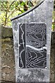
The Contour Canal
A plaque showing part of the Union Canal route which keeps to the 73m (240 foot) contour for its 50km length from Edinburgh to Falkirk. Opened in 1822, its lack of locks meant for speedier transport of goods, mainly coal and other minerals to the capital.
Image: © Jim Barton
Taken: 25 Sep 2013
0.11 miles