
IMAGES TAKEN NEAR TO
South Platt Hill Lane, NEWBRIDGE, EH28 8AJ
Introduction
This page details the photographs taken nearby to South Platt Hill Lane, EH28 8AJ by members of the Geograph project.
The Geograph project started in 2005 with the aim of publishing, organising and preserving representative images for every square kilometre of Great Britain, Ireland and the Isle of Man.

There are currently over 7.5m images from over14,400 individuals and you can help contribute to the project by visiting https://www.geograph.org.uk
Image Map
Images are licensed for reuse under creativecommons.org/licenses/by-sa/2.0
Notes
- Clicking on the map will re-center to the selected point.
- The higher the marker number, the further away the image location is from the centre of the postcode.
Image Listing (34 Images Found)
Images are licensed for reuse under creativecommons.org/licenses/by-sa/2.0
Image
Details
Distance
1
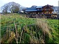
Ratho Hill
Park in the Bridge Inn's car park then walked along the canal. Over wall near woodland/field junction, then 2 fences to cross to get to summit near uncompleted wooden chalet. Then back to former trig site then canal back to bridge near the Bridge Inn with its cut mark.
Name: Ratho Hill
Hill number: 14294
Height: 117m / 384ft
Parent (Ma/M): 1809 East Cairn Hill
Section: 28A: Firth of Forth to the River Tweed
County/UA: Edinburgh (UA)
Class: Tump (100-199m)
Grid ref: NT 13188 71038
Summit feature: no feature
Drop: 35m
Col: 82m
Image: © Rude Health
Taken: 26 Dec 2014
0.03 miles
2
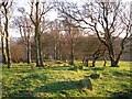
Platt Hill, trees
Looking south from the summit of Platt Hill, out of the square and towards Ratho.
Image: © Callum Black
Taken: 29 Jan 2006
0.03 miles
3
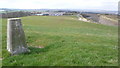
Trig point, Platt Hill
Looking West with the Edinburgh International Climbing Arena and the M8 spur cutting in the distance.
Image: © Calum McRoberts
Taken: 20 Apr 2008
0.03 miles
4

View west from Platt Hill
A view past the trig point on Platt Hill over West Lothian. The Ratho climbing centre is visible nearby.
Image: © Callum Black
Taken: 29 Jan 2006
0.03 miles
5

Trig point, Platt Hill
The Trig point lies very close to the edge of the square at 116 metres, not quite at the top of the hill.
Image: © Callum Black
Taken: 29 Jan 2006
0.03 miles
6

Trig point, Platt Hill
A short walk to here from a track that runs to the North, hemmed between the motorway and the hill, which is not shown on the map.
Image: © Calum McRoberts
Taken: 20 Apr 2008
0.04 miles
7
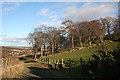
Platt Hill
The hill isn't named as such on the maps, but the track here is waymarked at both ends as a route between Ratho and Wilkie's Basin via Platt Hill. On the left is the point where the spur to the M9 diverges from the M8 motorway.
Image: © Anne Burgess
Taken: 15 Feb 2012
0.04 miles
8
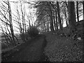
Path on Platt Hill
A path on the north side of the unmarked Platt Hill. Part of the Ratho path network. Looking east.
Image: © Callum Black
Taken: 29 Jan 2006
0.07 miles
9

Walkers on Union Canal
Two people take the canal path towards the Edinburgh International Climbing Arena. The path is heavily used by walkers, cyclists and anglers.
Image: © Calum McRoberts
Taken: 20 Apr 2008
0.08 miles
10

M8 Spur
Looking to the M8 spur from an unmarked track.
Image: © Calum McRoberts
Taken: 20 Apr 2008
0.10 miles