
IMAGES TAKEN NEAR TO
Hillhouse Terrace, KIRKNEWTON, EH27 8AR
Introduction
This page details the photographs taken nearby to Hillhouse Terrace, EH27 8AR by members of the Geograph project.
The Geograph project started in 2005 with the aim of publishing, organising and preserving representative images for every square kilometre of Great Britain, Ireland and the Isle of Man.

There are currently over 7.5m images from over14,400 individuals and you can help contribute to the project by visiting https://www.geograph.org.uk
Image Map
Images are licensed for reuse under creativecommons.org/licenses/by-sa/2.0
Notes
- Clicking on the map will re-center to the selected point.
- The higher the marker number, the further away the image location is from the centre of the postcode.
Image Listing (22 Images Found)
Images are licensed for reuse under creativecommons.org/licenses/by-sa/2.0
Image
Details
Distance
1
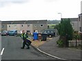
Litterpicking in Kirknewton
Kirknewton has expanded, not surprising considering the communications links. Street cleaning in the east of the village
Image: © Richard Webb
Taken: 4 Aug 2005
0.03 miles
2

The entrance to Kirknewton
The B7030 and NCN75 share this quieter road west from Edinburgh, a more peaceful alternative to the A71 Calder Road.
Image: © M J Richardson
Taken: 18 Nov 2008
0.09 miles
3

Sun Splitting The Trees on Footpath by Railway
This footpath is on the route of a former railway line, referred to as the Camps Line on old maps. Just West of where there is now a footbridge (a few hundred yards behind the photo location), there used to be a level crossing, and just West of this the still-operating railway line that passes through Kirknewton station split into two.
There are a few smaller paths running off to the right from the main path, mostly well-used and often by horses. At the start of the path, at the site of the old level crossing, are gates with a sign on them indicating that the path used to be the entrance to a landfill site. Whether the pile of stones and concrete on the left of the picture is related to this, or to the dismantled railway and possible associated buildings is unclear, but there are lots more big bits of stone and concrete, and bricks, nearby, mostly in amongst the trees.
Image: © Ian Dodds
Taken: 13 Aug 2020
0.12 miles
4

Welcome to Kirknewton
Entering the village from the east on Sustrans route 75.
Image: © michael ely
Taken: 18 Aug 2010
0.13 miles
5
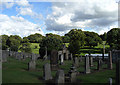
Kirknewton Graveyard
View from Main Street on Sustrans route 75.
Image: © michael ely
Taken: 18 Aug 2010
0.17 miles
6
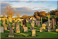
Old Kirkyard
This is the old burial ground, and the site of the original kirk of Kirknewton.
Image: © Anne Burgess
Taken: 2 Nov 2017
0.17 miles
7
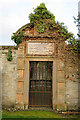
Entrance to Cullen Mausoleum
The mausoleum is on the site of the choir of the old kirk, and commemorates the celebrated physician, botanist and philosopher William Cullen (1710-1790), and his son Robert, Lord Cullen, eminent judge, elegant scholar and accomplished gentleman, who were of the Cullen family of Ormiston. See http://www.cullenproject.ac.uk/william-cullen/
Image: © Anne Burgess
Taken: 2 Nov 2017
0.17 miles
9

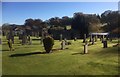
Kirknewton Graveyard
The site of an old church, but no sign of it now, two burial enclosures, and several 18 Century gravestones
Image: © M J Richardson
Taken: 18 Nov 2008
0.18 miles
10

Graveyard at Kirknewton
There was a church on this site, but no obvious sign of it now, only two burial enclosures, this one from 1864, of the Cullens
Image: © M J Richardson
Taken: 18 Nov 2008
0.18 miles