
IMAGES TAKEN NEAR TO
Knightslaw Place, PENICUIK, EH26 9EU
Introduction
This page details the photographs taken nearby to Knightslaw Place, EH26 9EU by members of the Geograph project.
The Geograph project started in 2005 with the aim of publishing, organising and preserving representative images for every square kilometre of Great Britain, Ireland and the Isle of Man.

There are currently over 7.5m images from over14,400 individuals and you can help contribute to the project by visiting https://www.geograph.org.uk
Image Map
Images are licensed for reuse under creativecommons.org/licenses/by-sa/2.0
Notes
- Clicking on the map will re-center to the selected point.
- The higher the marker number, the further away the image location is from the centre of the postcode.
Image Listing (15 Images Found)
Images are licensed for reuse under creativecommons.org/licenses/by-sa/2.0
Image
Details
Distance
1

Cornbank
A tidy 1960's housing estate to the west of Penicuik.(NT227603)
Image: © Richard Webb
Taken: 3 May 2005
0.04 miles
2

Shopping Centre without shops
This planners dream of a small shopping centre in the middle of the Cornbank housing estate in Penicuik never really prospered and no longer contains any retail outlets. The provision of a convenient bus service to and from the larger supermarkets in the town will have rendered any possible shops on this site even less viable.
Image: © Morley Sewell
Taken: 8 Jun 2009
0.13 miles
3

A766 approaching Penicuik
The A766 links the A702 to Penicuik where it joins the A701. The small bridge in the foreground crosses the Loan Burn.
Image: © Jim Barton
Taken: 20 May 2022
0.14 miles
4
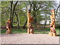
Woodland creatures
These sculptures have recently appeared in the wood beside Cornbank Primary School.
Image: © Mike Bremner
Taken: 22 May 2012
0.14 miles
5

Path by the Loan Burn, Penicuik (2)
A useful path between the A766 and Bog Road.
Image: © Jim Barton
Taken: 20 May 2022
0.15 miles
6

The Loan Burn, Penicuik
The burn drains eastwards from the slopes of Scald Law and Carnethy Hill.
Image: © Jim Barton
Taken: 20 May 2022
0.16 miles
7

The Penicuik Centre
This Centre, which opened in April 2007 includes a 25m swimming pool, health and fitness suites and a public library which allows public access to drop-in internet and email facilities.
Image: © Morley Sewell
Taken: 8 Jun 2009
0.16 miles
8

Path by the Loan Burn, Penicuik
This rural scene is only a few hundred metres from the main road through the town.
Image: © Jim Barton
Taken: 6 May 2014
0.17 miles
9
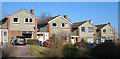
Rullion Road
Rullion Road is a long curving drive round a very large housing estate on the north-west of Penicuik.
Image: © Anne Burgess
Taken: 25 Feb 2018
0.18 miles
10

Power line, Penicuik
Power line poles crossing Bog Wood after the line emerged from underground at the nearest pole.
Image: © Jim Barton
Taken: 25 May 2026
0.19 miles