
IMAGES TAKEN NEAR TO
Armine Place, PENICUIK, EH26 8JP
Introduction
This page details the photographs taken nearby to Armine Place, EH26 8JP by members of the Geograph project.
The Geograph project started in 2005 with the aim of publishing, organising and preserving representative images for every square kilometre of Great Britain, Ireland and the Isle of Man.

There are currently over 7.5m images from over14,400 individuals and you can help contribute to the project by visiting https://www.geograph.org.uk
Image Map
Images are licensed for reuse under creativecommons.org/licenses/by-sa/2.0
Notes
- Clicking on the map will re-center to the selected point.
- The higher the marker number, the further away the image location is from the centre of the postcode.
Image Listing (24 Images Found)
Images are licensed for reuse under creativecommons.org/licenses/by-sa/2.0
Image
Details
Distance
1
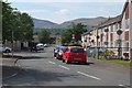
Nevis Gardens, Penicuik
In the Ladywood residential area with Carnethy and Turnhouse hills on the skyline.
Image: © Jim Barton
Taken: 14 Jul 2018
0.06 miles
2

The Esk Valley footpath
Officially the Penicuik-Musselburgh Foot and Cycleway, here following the line of the Edinburgh-Peebles railway line.
Image: © M J Richardson
Taken: 19 Mar 2009
0.07 miles
3

Steps up to Ladywood, Penicuik
A link to the cyclepath by the North Esk.
Image: © Jim Barton
Taken: 14 Jul 2018
0.09 miles
4
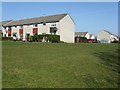
Houses at Ladywood
Armine Place from Assynt Bank.
Image: © M J Richardson
Taken: 19 Mar 2009
0.09 miles
5

Penicuik sewage works
Situated by the N Esk downstream of Esk Bridge; the Dalkeith - Penicuik cycleway and path passes the boundary fence.
Image: © Jim Barton
Taken: 15 Dec 2011
0.13 miles
6

Path, Lady's Wood
Managed by the Woodland Trust.
Image: © Richard Webb
Taken: 21 Feb 2023
0.13 miles
7

Penicuik Railway
The trackbed is being used as an access road to the sewage works.
Image: © Richard Webb
Taken: 25 Sep 2011
0.13 miles
8

Penicuik - Musselburgh Foot & Cycleway
At entrance to Sewage Works
Image: © Leslie Barrie
Taken: 19 Apr 2014
0.13 miles
9

Closely overhanging trees on the River North Esk
Looking upstream from the bridge by the sewage works. There was a dipper down there somewhere.
Image: © M J Richardson
Taken: 19 Mar 2009
0.13 miles
10

Path junction with the Dalkeith - Penicuik cycleway
A side path to Ladywood leaves the route of the former railway line.
Image: © Jim Barton
Taken: 15 Dec 2011
0.14 miles