
IMAGES TAKEN NEAR TO
Windsor Drive, PENICUIK, EH26 8EW
Introduction
This page details the photographs taken nearby to Windsor Drive, EH26 8EW by members of the Geograph project.
The Geograph project started in 2005 with the aim of publishing, organising and preserving representative images for every square kilometre of Great Britain, Ireland and the Isle of Man.

There are currently over 7.5m images from over14,400 individuals and you can help contribute to the project by visiting https://www.geograph.org.uk
Image Map
Images are licensed for reuse under creativecommons.org/licenses/by-sa/2.0
Notes
- Clicking on the map will re-center to the selected point.
- The higher the marker number, the further away the image location is from the centre of the postcode.
Image Listing (30 Images Found)
Images are licensed for reuse under creativecommons.org/licenses/by-sa/2.0
Image
Details
Distance
1

Traffic lights for Esk Bridge near Penicuik
Image: © Steven Brown
Taken: 27 May 2023
0.13 miles
2

Esk Bridge
Seen with difficulty from the west bank, just downstream.
Image: © M J Richardson
Taken: 19 Mar 2009
0.13 miles
3

Esk Bridge Penicuik
Traffic lights controlling this narrow bridge over the N Esk on a minor road E of Penicuik town centre. A photograph on http://www.kosmoid.net/penicuik/railway shows this scene in the days of the Penicuik railway.
Image: © Jim Barton
Taken: 15 Dec 2011
0.14 miles
4

Esk Bridge, Eskmills, Penicuik
Prior to 1812 this was the only bridge across the North Esk near Penicuik. It still carries the road which links the town to what was the main road to Edinburgh or the south until a turnpike was built by Thomas Telford.
Image: © Morley Sewell
Taken: 4 Aug 2008
0.15 miles
5

Path signs, Penicuik Railway trackbed
The trackbed approaching the site of Eskbridge Station.
Image: © Richard Webb
Taken: 19 Apr 2016
0.15 miles
6

Eastfield Drive
Eastfield Drive is the principal road of a large housing estate east of the main road through Penicuik.
Image: © Anne Burgess
Taken: 25 Feb 2018
0.15 miles
7

Eskbridge Station site
On the Penicuik Railway, now a path.
Image: © Richard Webb
Taken: 11 Apr 2021
0.16 miles
8

Penicuik - Musselburgh Foot & Cycleway
At Esk Bridge
Image: © Leslie Barrie
Taken: 19 Apr 2014
0.16 miles
9

Water treatment works.
The river North Esk runs through Penicuik in a deep wooded valley. This is the sewage treatment plant taken from a former railway bridge over the river.
Image: © Richard Webb
Taken: 30 May 2005
0.16 miles
10
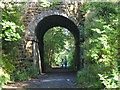
Bridge over former railway, Penicuik
The minor road east from Esk Bridge crosses the Penicuik to Musselburgh cyclepath.
Image: © Jim Barton
Taken: 29 Aug 2023
0.17 miles