
IMAGES TAKEN NEAR TO
PENICUIK, EH26 0PU
Introduction
This page details the photographs taken nearby to EH26 0PU by members of the Geograph project.
The Geograph project started in 2005 with the aim of publishing, organising and preserving representative images for every square kilometre of Great Britain, Ireland and the Isle of Man.

There are currently over 7.5m images from over14,400 individuals and you can help contribute to the project by visiting https://www.geograph.org.uk
Image Map
Images are licensed for reuse under creativecommons.org/licenses/by-sa/2.0
Notes
- Clicking on the map will re-center to the selected point.
- The higher the marker number, the further away the image location is from the centre of the postcode.
Image Listing (8 Images Found)
Images are licensed for reuse under creativecommons.org/licenses/by-sa/2.0
Image
Details
Distance
1
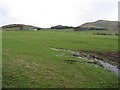
Rullion Green in winter
Compare Richard Webb's spring picture Image
Image: © M J Richardson
Taken: 12 Jan 2009
0.05 miles
2

Rullion Green
Sheep grazing on the flanks of the Pentland Hills. There is a cattle crush in the foreground, a device for restraining cattle to make it possible to do "maintenance" on them, such as administering medicines.
Image: © Richard Webb
Taken: 30 May 2005
0.13 miles
3
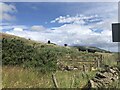
Gate, Marchwell
Fields on Lawhead Hill, beside the A702.
Image: © Richard Webb
Taken: 15 Jul 2023
0.14 miles
4
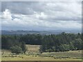
Fields and woods, Marchwell
Penicuik is expanding into the space beyond the trees.
Image: © Richard Webb
Taken: 15 Jul 2023
0.18 miles
5

Wet grazing at House o' Muir
Looking towards Turnhouse Hill from the A702.
Image: © M J Richardson
Taken: 12 Jan 2009
0.22 miles
6
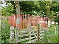
Martyr's Monument, Rullion Green
The monument commemorates those Covenanters (Presbyterians who refused to accept interference by the Stuart monarchy in the Church of Scotland) who fell in battle here on 28 November 1666 in a rout by the Government troops, commanded by General Thomas (Tam) Dalyell of the Binns (an ancestor of the 20th Century Labour MP of the same name).
Since this 1969 photo Image, the area around the monument has become more overgrown, but the railings have had a lick of paint recently.
Image: © Alan O'Dowd
Taken: 14 Sep 2017
0.22 miles
7
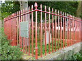
Martyr's Monument, Rullion Green
The monument commemorates those Covenanters (Presbyterians who refused to accept interference by the Stuart monarchy in the Church of Scotland) who fell in battle here on 28 November 1666 in a rout by the Government troops, commanded by General Thomas (Tam) Dalyell of the Binns (an ancestor of the 20th Century Labour MP of the same name).
Since this 1969 photo Image the area around the monument has become more overgrown, but the railings have had a lick of paint recently.
Image: © Alan O'Dowd
Taken: 14 Sep 2017
0.22 miles
8

Rullion Green Martyrs' Monument
Here at what is known as the 'Preaching Field' the Battle of Rullion Green took place on the 28th November 1666. An army of around 900 Covenanters commanded by Colonel James Wallace were confronted by a government army of over 3,000 soldiers under General Tam Dalziel of the Binns -'Bloody Tam'. The result was a rout with much slaughter.A service is held here on the anniversary each year. Interestingly Robert Louis Stevenson's first published book when aged 16 was an account of the battle, "The Pentland Rising: a Page of History,1666".
Image: © ronnie leask
Taken: 16 Feb 1969
0.23 miles