
IMAGES TAKEN NEAR TO
Knowetop Place, ROSLIN, EH25 9NR
Introduction
This page details the photographs taken nearby to Knowetop Place, EH25 9NR by members of the Geograph project.
The Geograph project started in 2005 with the aim of publishing, organising and preserving representative images for every square kilometre of Great Britain, Ireland and the Isle of Man.

There are currently over 7.5m images from over14,400 individuals and you can help contribute to the project by visiting https://www.geograph.org.uk
Image Map
Images are licensed for reuse under creativecommons.org/licenses/by-sa/2.0
Notes
- Clicking on the map will re-center to the selected point.
- The higher the marker number, the further away the image location is from the centre of the postcode.
Image Listing (17 Images Found)
Images are licensed for reuse under creativecommons.org/licenses/by-sa/2.0
Image
Details
Distance
1
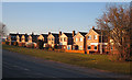
Crusader Drive
These are the backs of houses whose fronts are on Crusader Drive.
Image: © Anne Burgess
Taken: 25 Feb 2018
0.11 miles
2

Penicuik Road, Roslin
The B7003 heading into Roslin from the Gowkley Moss roundabout. The building L of centre houses Roslin medical practice.
Image: © Jim Barton
Taken: 16 Dec 2015
0.12 miles
3
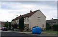
Recycling, Roslin
Paper bin in a modern housing estate on the western edge of Roslin.
Image: © Richard Webb
Taken: 1 Aug 2005
0.13 miles
4

Roadside scrub, Roslin
Scrub beside the Penicuik Road which may have been realigned.
Image: © Richard Webb
Taken: 18 Feb 2012
0.15 miles
5

New Houses off Penicuik Road
Houses are going up on the outskirts of just about every town and village near Edinburgh, and Roslin is no exception.
Image: © Anne Burgess
Taken: 4 Nov 2017
0.16 miles

7

Dog waste disposal point, Roslin
It's an unfortunate fact of life that paths in suburban outskirts become dogs' toilets, but at least here there are free bags and a disposal point.
Image: © Jim Barton
Taken: 16 Dec 2015
0.17 miles
8
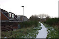
Footpath at Roslin
The path follows the route of the former railway to Penicuik, then swings W across land reclaimed from old colliery spoil heaps and brickworks.
Image: © Jim Barton
Taken: 6 Dec 2011
0.17 miles

10

Minor road by Roslin
Passing Oatslie and a landfill site.
Image: © Richard Webb
Taken: 17 Feb 2021
0.19 miles