
IMAGES TAKEN NEAR TO
Craigathie Road, EH25 9BG
Introduction
This page details the photographs taken nearby to Craigathie Road, EH25 9BG by members of the Geograph project.
The Geograph project started in 2005 with the aim of publishing, organising and preserving representative images for every square kilometre of Great Britain, Ireland and the Isle of Man.

There are currently over 7.5m images from over14,400 individuals and you can help contribute to the project by visiting https://www.geograph.org.uk
Image Map
Images are licensed for reuse under creativecommons.org/licenses/by-sa/2.0
Notes
- Clicking on the map will re-center to the selected point.
- The higher the marker number, the further away the image location is from the centre of the postcode.
Image Listing (28 Images Found)
Images are licensed for reuse under creativecommons.org/licenses/by-sa/2.0
Image
Details
Distance
1

Track nearing B7006, Roslin
The track and path from the Moat colliery site emerges on the B7006 near the entrance to the Roslin Bio Centre Image
Image: © Jim Barton
Taken: 16 Dec 2015
0.10 miles
2

Track to B7006, Roslin
A farm track and path through fields to the north of Roslin.
Image: © Jim Barton
Taken: 16 Dec 2015
0.11 miles
3
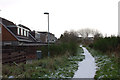
Footpath at Roslin
The path follows the route of the former railway to Penicuik, then swings W across land reclaimed from old colliery spoil heaps and brickworks.
Image: © Jim Barton
Taken: 6 Dec 2011
0.11 miles
4
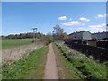
Edinburgh, Loanhead and Roslin Railway
Now a path, this was once one of the two railways into Penicuik. A mineral line spur from Roslin Colliery joined here.
Image: © Richard Webb
Taken: 19 Apr 2016
0.12 miles
5
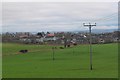
Fields around Roslin
The NW side of Roslin seen from the path to the B7006 on a very mild mid-December day.
Image: © Jim Barton
Taken: 16 Dec 2015
0.12 miles
6

New houses for Roslin
St Clair Mews, a David Wilson Homes development, at the northern end of Roslin
Image: © Eirian Evans
Taken: 11 Sep 2021
0.12 miles
7
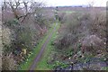
Path on former railway line, Roslin
The line ran from Millerhill to Glencorse Barracks via Loanhead and is now a path from Loanhead, seen here from the road bridge.
Image: © Jim Barton
Taken: 16 Dec 2015
0.13 miles
8

Footpath to Loanhead
Sign indicating the start of the path on the B7006 Bilston-Roslin Road at Killburn.
Image: © M J Richardson
Taken: 24 Nov 2010
0.14 miles
9

Developer's sign, Comyn Drive
New houses on ground once used as a playing field in Roslin. The entrance to the Roslin Institute was here, older sign visible below the builder's one. The institute, of cloning fame is now at Easter Bush.
Image: © Richard Webb
Taken: 21 Feb 2023
0.14 miles
10

Car park and path near Roslin
Paths to Bilston Viaduct and the Loanhead Railway Path from the B7006 north of Roslin.
Image: © Jim Barton
Taken: 16 Dec 2015
0.14 miles