
IMAGES TAKEN NEAR TO
Whitehill Road, ROSEWELL, EH24 9DL
Introduction
This page details the photographs taken nearby to Whitehill Road, EH24 9DL by members of the Geograph project.
The Geograph project started in 2005 with the aim of publishing, organising and preserving representative images for every square kilometre of Great Britain, Ireland and the Isle of Man.

There are currently over 7.5m images from over14,400 individuals and you can help contribute to the project by visiting https://www.geograph.org.uk
Image Map
Images are licensed for reuse under creativecommons.org/licenses/by-sa/2.0
Notes
- Clicking on the map will re-center to the selected point.
- The higher the marker number, the further away the image location is from the centre of the postcode.
Image Listing (29 Images Found)
Images are licensed for reuse under creativecommons.org/licenses/by-sa/2.0
Image
Details
Distance
1

Farm track, Rosewell
Beside a wheatfield. Area a mix of farmland and small woods.
Image: © Richard Webb
Taken: 20 Jul 2005
0.02 miles
2

Rosewell Institute
Category B-listed. Built 1917. Architect James McLachlan.
Image: © Leslie Barrie
Taken: 19 Apr 2014
0.05 miles


5

Rosewell Parish Church
Rosewell Parish Church, Midlothian was built in the 1870s, initially as a daughter church of Lasswade Parish Church. In 1991 the church was "linked" with both Cockpen & Carrington Parish Church and Lasswade Parish Church.
Image: © Mr H
Taken: 18 Aug 2007
0.07 miles
6
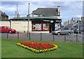
Rosewell
Mining village, now expanding as a commuter settlement. It has a new bypass and much of the land between the village and the bypass is being built upon. View of the centre, including the village shop.
Image: © Richard Webb
Taken: 20 Jul 2005
0.08 miles
7

Rosewell Parish Church
The external bell rope at Rosewell.
Image: © Richard Webb
Taken: 25 Sep 2011
0.08 miles
8

Carnethie Street, Rosewell
Junction in the centre of the village.
Image: © Richard Webb
Taken: 21 Aug 2015
0.08 miles
9

Trees in the park, Rosewell
Recreation ground, Rosewell.
Image: © Richard Webb
Taken: 10 Oct 2013
0.09 miles
10

The Steading, Rosewell
Community centre and cafe. It was being used for Covid vaccinations.
Image: © Richard Webb
Taken: 4 Nov 2022
0.09 miles