
IMAGES TAKEN NEAR TO
GOREBRIDGE, EH23 4NU
Introduction
This page details the photographs taken nearby to EH23 4NU by members of the Geograph project.
The Geograph project started in 2005 with the aim of publishing, organising and preserving representative images for every square kilometre of Great Britain, Ireland and the Isle of Man.

There are currently over 7.5m images from over14,400 individuals and you can help contribute to the project by visiting https://www.geograph.org.uk
Image Map
Images are licensed for reuse under creativecommons.org/licenses/by-sa/2.0
Notes
- Clicking on the map will re-center to the selected point.
- The higher the marker number, the further away the image location is from the centre of the postcode.
Image Listing (56 Images Found)
Images are licensed for reuse under creativecommons.org/licenses/by-sa/2.0
Image
Details
Distance

2

Car park, Vogrie
A complicated procedure is required to park here, and watch out for the one way ramp on the way out. The park is being used for a small orienteering event.
Image: © Richard Webb
Taken: 28 Dec 2008
0.05 miles
3

Vogrie Country Park
Looking back over the entrance to the car park (token to operate barrier costs £1 from machine which gives change if/as required) .... the little building houses loos (male/female/disabled, no charge).
Image: © Barbara Carr
Taken: 30 Apr 2013
0.06 miles
4

Walled garden, Vogrie Country Park
Fruit trees trained up the perimeter wall of the garden in the grounds of Vogrie House, now a Country Park run by Midlothian Council Ranger Service.
Image: © Jim Barton
Taken: 18 Oct 2013
0.06 miles
5
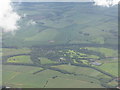
Vogrie Estate Country Park
Seen from over Newtongrange looking southeast. One of Midlothian's country parks, and the headquarters of The Wildlife Information Centre for the Lothians and Borders http://www.wildlifeinformation.co.uk/index.php . Some of the crops to the left, in the angle between the left/right line of trees and the belt at right angles going left towards the farm buildings at bottom left, are the willow biomass crops that feature in the shared description of earlier images.
Image: © M J Richardson
Taken: 24 Jun 2012
0.07 miles
6

Miniature railway, Vogrie Country Park
A loop of line south of the walled garden.
Image: © Jim Barton
Taken: 2 Jun 2023
0.07 miles
7

Vogrie Country Park.
House and grounds of Vogrie. On today's evidence a very popular day out.
Image: © Richard Webb
Taken: 4 Sep 2005
0.07 miles
8

Drive to Vogrie House
The grounds of the 19th century Vogrie House are now a Country Park, managed by Midlothian Council. The hut is an information point.
Image: © Jim Barton
Taken: 25 Nov 2022
0.08 miles
9

Robin (Erithacus rubecula) in the car park at Vogrie Country Park
Image: © Mike Pennington
Taken: 4 Jan 2017
0.08 miles
10

Vogrie Country Park
One of two barbecue areas, providing undercover eating area plus kitchen-with-a-view! Also plenty of play-space for energetic people/pets.
Image: © Barbara Carr
Taken: 30 Apr 2013
0.08 miles