
IMAGES TAKEN NEAR TO
Rowantree Road, DALKEITH, EH22 5ER
Introduction
This page details the photographs taken nearby to Rowantree Road, EH22 5ER by members of the Geograph project.
The Geograph project started in 2005 with the aim of publishing, organising and preserving representative images for every square kilometre of Great Britain, Ireland and the Isle of Man.

There are currently over 7.5m images from over14,400 individuals and you can help contribute to the project by visiting https://www.geograph.org.uk
Image Map
Images are licensed for reuse under creativecommons.org/licenses/by-sa/2.0
Notes
- Clicking on the map will re-center to the selected point.
- The higher the marker number, the further away the image location is from the centre of the postcode.
Image Listing (18 Images Found)
Images are licensed for reuse under creativecommons.org/licenses/by-sa/2.0
Image
Details
Distance
1

David Scott Avenue
On the northeastern outskirts of Mayfield.
Image: © M J Richardson
Taken: 27 Aug 2009
0.08 miles
2

Demolition site, Easthouses
Appears to be the site of a school. Seen from Conifer Road.
Image: © Richard Webb
Taken: 30 Jul 2014
0.11 miles
3

Mayfield Dental Surgery
Located in Mayfield Place, almost opposite the Leisure Centre.
Image: © Richard Dorrell
Taken: 13 Jan 2011
0.12 miles
4
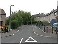
Camp Road
A small cul-de-sac, off Rowantree Road.
Image: © M J Richardson
Taken: 27 Aug 2009
0.12 miles
5

Shops in Mayfield Place
This row of shops are opposite the Mayfield Leisure Centre.
Image: © Richard Dorrell
Taken: 13 Jan 2011
0.13 miles
6
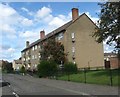
Flats in Buckie Road at Mayfield
Near Newtongrange in Midlothian.
Image: © James Denham
Taken: 2 Sep 2009
0.13 miles
7

Mayfield Leisure Centre
The centre is located in Mayfield Place, and provides leisure facilities for the local community including a large sports hall, multi-purpose hall, fully equipped Tonezone, weight training room, hydrotherapy suite including spa and sauna, soft play area and outdoor artificial pitches for football and tennis.
Image: © Richard Dorrell
Taken: 13 Jan 2011
0.14 miles

9

Mayfield and Easthouses Church
The church was dedicated Friday 23rd September 1955, and a church hall added in 1963. The church has always been important to the local area as a community centre, being host to many clubs and organisations including Choir, Bible Class, Sunday School, Cubs, Scouts, Brownies, Boy's Brigade, Youth Fellowship, Young Mothers' Fellowship and Women's Guild.
Image: © Richard Dorrell
Taken: 13 Jan 2011
0.16 miles
10
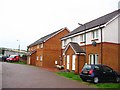
Mayfield
Some newer houses on the edge of Mayfield. The rest of the square is currently mostly barley fields.
Image: © Richard Webb
Taken: 11 Aug 2005
0.16 miles