
IMAGES TAKEN NEAR TO
Main Street, DALKEITH, EH22 4PS
Introduction
This page details the photographs taken nearby to Main Street, EH22 4PS by members of the Geograph project.
The Geograph project started in 2005 with the aim of publishing, organising and preserving representative images for every square kilometre of Great Britain, Ireland and the Isle of Man.

There are currently over 7.5m images from over14,400 individuals and you can help contribute to the project by visiting https://www.geograph.org.uk
Image Map
Images are licensed for reuse under creativecommons.org/licenses/by-sa/2.0
Notes
- Clicking on the map will re-center to the selected point.
- The higher the marker number, the further away the image location is from the centre of the postcode.
Image Listing (111 Images Found)
Images are licensed for reuse under creativecommons.org/licenses/by-sa/2.0
Image
Details
Distance
1

Junction for Fourth Street, Newtongrange
The SW end of Fourth Street at its junction with Main Street.
Image: © Jim Barton
Taken: 1 Feb 2019
0.00 miles
2
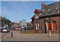
Main Street, Newtongrange
Main Street from its junction with Lingerwood Road. In the foreground is one of the distinctive brick-built cottages of the 19th century mining village.
Image: © Jim Barton
Taken: 1 Apr 2022
0.02 miles
3
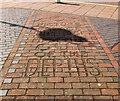
Picture Palace cinema commemoration, Newtongrange
Brickwork in the pavement at the junction of Lingerwood Road and Main Street commemorating the Picture Palace 1915 - 1961, first film Out of the Depths.
It was situated across the road and the site is now occupied by a block of flats. There is a photograph of the cinema on the Canmore web page https://canmore.org.uk/site/290825/newtongrange-4-muirdean-road-site-of-cinema (incorrectly titled as 4 Muirdean Road instead of Murderdean Road).
Image: © Jim Barton
Taken: 1 Apr 2022
0.02 miles
4
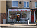
Cafe on Main Street, Newtongrange
Cafe and takeaway business near the junction with Lingerwood Road.
Image: © Jim Barton
Taken: 1 Apr 2022
0.02 miles
5

Main Street, Newtongrange
Newtongrange ('Nitten') was built as a mining village in the 1890s for the Lady Victoria Colliery, now home to the National Mining Museum. On the A7 and the Borders Railway it is now in the commuter area for Edinburgh and Midlothian.
Image: © Jim Barton
Taken: 1 Feb 2019
0.03 miles
6

Main Street and A7, Newtongrange
The former mining village expanded around the Lady Victoria colliery which opened in 1890, now the National Mining Museum: note the former pithead wheel R of centre. A new station is being built near here on the Borders Railway, due to open in September.
Image: © Jim Barton
Taken: 16 Mar 2015
0.03 miles
7

Cottages, Newtongrange
Distinctive cottages on Main Street in this mining village built around the Lady Victoria Colliery.
Image: © Jim Barton
Taken: 2 Nov 2018
0.04 miles
8
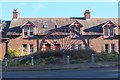
Pithead wheel, Newtongrange
A winding wheel set up at the junction of Main Street and the A7 next to the former Lady Victoria Colliery, now the National Mining Museum - see Image
Image: © Jim Barton
Taken: 2 Nov 2018
0.05 miles
9

A7 junction, Newtongrange
The junction with Main Street (R) leading into the village. On the right is one of the pithead wheels set up to commemorate the Lady Victoria Colliery, now the National Mining Museum. The viewpoint is an embankment for a former tramway to the colliery, now a short stretch of footpath.
Image: © Jim Barton
Taken: 1 Nov 2019
0.05 miles
10

Pit and village
The colliery village of Newtongrange seen from Lady Victoria colliery (Scottish National Mining Museum).
Image: © Alan Murray-Rust
Taken: 10 Jun 2013
0.05 miles