
IMAGES TAKEN NEAR TO
Easthouses Industrial Estate, DALKEITH, EH22 4DJ
Introduction
This page details the photographs taken nearby to Easthouses Industrial Estate, EH22 4DJ by members of the Geograph project.
The Geograph project started in 2005 with the aim of publishing, organising and preserving representative images for every square kilometre of Great Britain, Ireland and the Isle of Man.

There are currently over 7.5m images from over14,400 individuals and you can help contribute to the project by visiting https://www.geograph.org.uk
Image Map
Images are licensed for reuse under creativecommons.org/licenses/by-sa/2.0
Notes
- Clicking on the map will re-center to the selected point.
- The higher the marker number, the further away the image location is from the centre of the postcode.
Image Listing (19 Images Found)
Images are licensed for reuse under creativecommons.org/licenses/by-sa/2.0
Image
Details
Distance
1
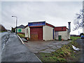
Sunflower Chinese Takeaway, Easthouses
Located in Mayfield Road. An odd-looking little premises with some health and safety questionable steps and slopes. I wonder what its purpose might have been when it was built?
Image: © Richard Dorrell
Taken: 13 Jan 2011
0.07 miles
2
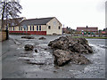
Ice sculpture?
Snow, piled up on street corners, gradually melts away in ugly grey heaps - not at all like the fluffy white blanket of a few days ago!
This is at the junction of Easthouses Road and Mayfield Road, Easthouses.
Image: © Richard Dorrell
Taken: 13 Jan 2011
0.08 miles
3
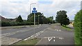
Alleged cycle path, Easthouses Road
A supposed cycle path where there is an expectation of getting off and pushing every 100 metres or so. The stupid blue signs are only advisory. Perhaps the planners responsible could be advised to try cycling themselves first.
Image: © Richard Webb
Taken: 30 Jul 2014
0.08 miles
4
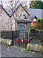
Easthouses war memorial
This simple memorial, in a corner site on Easthouses Road, commemorates seven local men who fell in the First World War.
Image: © Richard Dorrell
Taken: 13 Jan 2011
0.09 miles
5
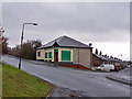
Your Store, Easthouses
A traditional 'corner shop' on the junction of Mayfield Road and Broadhurst Road.
Image: © Richard Dorrell
Taken: 13 Jan 2011
0.10 miles
6
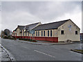
Easthouses Miners Welfare & Social Club
Located in Easthouses Road. The building has the look of having formerly been a school.
Image: © Richard Dorrell
Taken: 13 Jan 2011
0.11 miles
7
Site of Easthouses Colliery
Now partly occupied by Easthouses Industrial Estate.
I was visiting sites used by the Ordnance Survey for triangulation which is a great way of uncovering the exact location of lost industries.
Be careful here, the locals are not friendly. A graduate of charm school with a bad dose of wee man syndrome tried to question me in a very unpleasant manner on leaving.
Image: © Richard Webb
Taken: 30 Jul 2014
0.11 miles
8
Site of Easthouses Colliery
Location from the Ordnance Survey triangulation points database. Unfortunately the site is now part of the Easthouses Industrial Estate. There are no obvious access restrictions but I was subjected to questioning from an unpleasant aggressive little man.
Image: © Richard Webb
Taken: 30 Jul 2014
0.12 miles
9
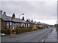
Broadhurst Road, Easthouses
A row of neat small bungalows face across the road to a grassed area.
Image: © Richard Dorrell
Taken: 13 Jan 2011
0.13 miles
10

Shops in Easthouses Road
Two of the units here are takeaway food outlets.
Image: © Richard Dorrell
Taken: 13 Jan 2011
0.13 miles