
IMAGES TAKEN NEAR TO
Thornyhall, DALKEITH, EH22 2ND
Introduction
This page details the photographs taken nearby to Thornyhall, EH22 2ND by members of the Geograph project.
The Geograph project started in 2005 with the aim of publishing, organising and preserving representative images for every square kilometre of Great Britain, Ireland and the Isle of Man.

There are currently over 7.5m images from over14,400 individuals and you can help contribute to the project by visiting https://www.geograph.org.uk
Image Map
Images are licensed for reuse under creativecommons.org/licenses/by-sa/2.0
Notes
- Clicking on the map will re-center to the selected point.
- The higher the marker number, the further away the image location is from the centre of the postcode.
Image Listing (20 Images Found)
Images are licensed for reuse under creativecommons.org/licenses/by-sa/2.0
Image
Details
Distance
1

Path between houses, Thornybank
The path cuts through from the B6414 Salter's Road to the Penicuik - Musselburgh cyclepath.
Image: © Jim Barton
Taken: 17 Jul 2018
0.05 miles


4

Old toll house
On Salter's Road, A6094, north out of Dalkeith towards Musselburgh. This old toll house has had modern extensions built on both sides. The front porch has had the door removed and replaced with a window above new stonework. In 'Dalkeith, Aspects of the history of a Scottish Burgh' David Smith 2019, it is said to have been built in 1804. On the OS 6" map, 1852/53 it is named as Cow Bridge TP
Image: © John Riddell
Taken: 20 Feb 2021
0.06 miles
5

Salters Road (A6094)
Heading north east beside Cowbridge Park.
Image: © JThomas
Taken: 15 May 2015
0.10 miles
6
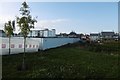
Building site, Thornybank
Nearing the end of house building on a former factory site in Dalkeith.
Image
Image: © Richard Webb
Taken: 18 Aug 2016
0.11 miles


9
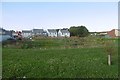
New houses, Thornybank
The Millerhill development on former industrial land in Dalkeith.
Image: © Richard Webb
Taken: 18 Aug 2016
0.13 miles
10
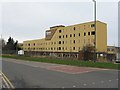
Forrest Furnishing
Still derelict, 4 years on - see Image
Image: © M J Richardson
Taken: 15 Mar 2009
0.13 miles