
IMAGES TAKEN NEAR TO
Sandyriggs Loan, DALKEITH, EH22 2FS
Introduction
This page details the photographs taken nearby to Sandyriggs Loan, EH22 2FS by members of the Geograph project.
The Geograph project started in 2005 with the aim of publishing, organising and preserving representative images for every square kilometre of Great Britain, Ireland and the Isle of Man.

There are currently over 7.5m images from over14,400 individuals and you can help contribute to the project by visiting https://www.geograph.org.uk
Image Map
Images are licensed for reuse under creativecommons.org/licenses/by-sa/2.0
Notes
- Clicking on the map will re-center to the selected point.
- The higher the marker number, the further away the image location is from the centre of the postcode.
Image Listing (22 Images Found)
Images are licensed for reuse under creativecommons.org/licenses/by-sa/2.0
Image
Details
Distance

2
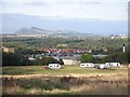
Wester Cowden
The fields await housing development as Dalkeith expands. Meanwhile they are hosting travellers who have improved the access from the public road with new tarmac. Arthur's Seat in the background.
Image: © Richard Webb
Taken: 12 Oct 2007
0.07 miles
3

Ryndale Drive
Houses surrounding an informal green space.
Image: © Richard Webb
Taken: 28 May 2020
0.08 miles
4

Letts, Charles and Co. Dalkeith
Now surrounded by houses.
Image: © Richard Webb
Taken: 28 May 2020
0.10 miles
5

New housing at Thornybank
With a nice view over the industrial estate, with the derelict Forrest Furnishing building on the left, and Arthur's Seat in the distance.
Image: © M J Richardson
Taken: 15 Mar 2009
0.10 miles
6

Path, Ryndale Drive
Security fencing from a previous land use, presumably industrial.
Image: © Richard Webb
Taken: 28 May 2020
0.11 miles
7

High-rise at Thorneybank
New housing on the eastern outskirts of Dalkeith. Not my idea of sympathetic development in a rural landscape, even if it is post-industrial.
Image: © M J Richardson
Taken: 15 Mar 2009
0.12 miles
8

Langside Park
A rectangular area left by the housing developers.
Image: © Richard Webb
Taken: 28 May 2020
0.14 miles

