
IMAGES TAKEN NEAR TO
Old Dalkeith Road, DALKEITH, EH22 1RR
Introduction
This page details the photographs taken nearby to Old Dalkeith Road, EH22 1RR by members of the Geograph project.
The Geograph project started in 2005 with the aim of publishing, organising and preserving representative images for every square kilometre of Great Britain, Ireland and the Isle of Man.

There are currently over 7.5m images from over14,400 individuals and you can help contribute to the project by visiting https://www.geograph.org.uk
Image Map
Images are licensed for reuse under creativecommons.org/licenses/by-sa/2.0
Notes
- Clicking on the map will re-center to the selected point.
- The higher the marker number, the further away the image location is from the centre of the postcode.
Image Listing (42 Images Found)
Images are licensed for reuse under creativecommons.org/licenses/by-sa/2.0
Image
Details
Distance
1

Entrance to Todhills
The view of the cars parked in the entrance from the main road (the A7) to the Todhills Industrial/Retail Estate.
Image: © Sandy Gemmill
Taken: 26 Oct 2007
0.06 miles
2
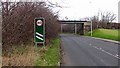
Old Dalkeith Road
The A68, now renumbered for some reason as the A7 passes under the disused Bilstonn Glen mineral line.
Image: © Richard Webb
Taken: 11 Jan 2012
0.08 miles
3
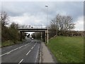
Old Dalkeith Road
The A68, now renumbered A7 passes under the long disused Edinburgh, Loanhead and Roslin Railway.
Image: © Richard Webb
Taken: 28 Mar 2014
0.08 miles
4

Descent from the railway path
Path linking the rails to trails path to Loanhead with the A775 (old A7) at Danderhall.
Image: © Richard Webb
Taken: 31 May 2020
0.10 miles
5
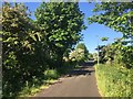
Shawfair to Loanhead cycle path
Newly built on the Bilston Glen Colliery railway trackbed.
Image: © Richard Webb
Taken: 31 May 2020
0.10 miles
6
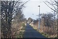
Roslin cycle path
Former Bilston Glen Colliery railway.
Image: © Richard Webb
Taken: 17 Feb 2021
0.10 miles
7

Field, Todhills
Inside the city bypass and a candidate for development.
Image: © Richard Webb
Taken: 31 May 2020
0.12 miles

9

Danderhall
The current edge, but the unused field will probably be built upon.
Image: © Richard Webb
Taken: 17 Feb 2021
0.14 miles
10

Field, Danderhall
Urban fringe and probably on some developer's hit list.
Image: © Richard Webb
Taken: 31 May 2020
0.14 miles