
IMAGES TAKEN NEAR TO
Woolmet Crescent, DALKEITH, EH22 1NL
Introduction
This page details the photographs taken nearby to Woolmet Crescent, EH22 1NL by members of the Geograph project.
The Geograph project started in 2005 with the aim of publishing, organising and preserving representative images for every square kilometre of Great Britain, Ireland and the Isle of Man.

There are currently over 7.5m images from over14,400 individuals and you can help contribute to the project by visiting https://www.geograph.org.uk
Image Map
Images are licensed for reuse under creativecommons.org/licenses/by-sa/2.0
Notes
- Clicking on the map will re-center to the selected point.
- The higher the marker number, the further away the image location is from the centre of the postcode.
Image Listing (15 Images Found)
Images are licensed for reuse under creativecommons.org/licenses/by-sa/2.0
Image
Details
Distance

2
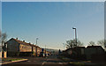
Edmonstone Road Danderhall
Traffic calming measures.
Image: © John Taylor
Taken: 6 Dec 2008
0.10 miles
3

Gateway to Woolmet House
The 17th Century house was demolished in 1954, and the gateway now graces Danderhall Miners Welfare and Social Club.
Image: © M J Richardson
Taken: 6 May 2010
0.16 miles
4

Woolmet House Gateway, Danderhall
Category A-listed. Built c1686. Woolmet House was abandoned and later demolished in 1954 due to cracks appearing as a result of underground mine workings. Beyond the gateway is now the Danderhall Miners Welfare and Social Club.
Image: © Leslie Barrie
Taken: 18 Oct 2014
0.16 miles
5
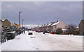
Edmonstone Road in the snow
Even after several days the snow still makes getting about difficult.
Image: © John Taylor
Taken: 4 Jan 2010
0.17 miles
6

Danderhall Miners Welfare and Social Club
And the gateway to Woolmet House, a fine mansion which dated from 1686 but was demolished in 1954.
Image: © M J Richardson
Taken: 6 May 2010
0.17 miles
7

Edmonstone Road
View towards the Edmonstone Inn in Danderhall.
Image: © Richard Webb
Taken: 28 Mar 2014
0.17 miles
8

Blackdean Road in Danderhall
Part of a recent housing development in the Midlothian village.
Image: © James Denham
Taken: 17 May 2010
0.19 miles
9
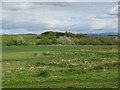
Fields at Danderhall
Looking across to the Woolmet woodland, a reclaimed colliery site, from the miners' welfare.
Image: © M J Richardson
Taken: 6 May 2010
0.21 miles
10
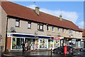
Shops & Post Office, Newton Church Road, Danderhall
Image: © Leslie Barrie
Taken: 18 Oct 2014
0.22 miles