
IMAGES TAKEN NEAR TO
Newmills Road, DALKEITH, EH22 1ET
Introduction
This page details the photographs taken nearby to Newmills Road, EH22 1ET by members of the Geograph project.
The Geograph project started in 2005 with the aim of publishing, organising and preserving representative images for every square kilometre of Great Britain, Ireland and the Isle of Man.

There are currently over 7.5m images from over14,400 individuals and you can help contribute to the project by visiting https://www.geograph.org.uk
Image Map
Images are licensed for reuse under creativecommons.org/licenses/by-sa/2.0
Notes
- Clicking on the map will re-center to the selected point.
- The higher the marker number, the further away the image location is from the centre of the postcode.
Image Listing (48 Images Found)
Images are licensed for reuse under creativecommons.org/licenses/by-sa/2.0
Image
Details
Distance
1

The Unicorn at Dalkeith
Disused pub on Newmills Road [the old A68, now A6106 since the bypass opened].
Image: © M J Richardson
Taken: 26 Jun 2012
0.01 miles
2

Dalkeith High School site 2012
An update on Image taken in 2008 - the site has now been cleared, to reveal a completely different view from the bridge, of houses on Elmfield Park..
Image: © M J Richardson
Taken: 26 Jun 2012
0.04 miles
3

Dalkeith High School site 2012
All school buildings have now been cleared - compare Image - the barrier on the right is the same as the one on the right in the earlier picture.
Image: © M J Richardson
Taken: 26 Jun 2012
0.04 miles

5
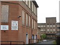
Dalkeith High School
Possibly a comment on the current state of education. These buildings have been boarded up for years.
Image: © M J Richardson
Taken: 6 Nov 2008
0.07 miles
6
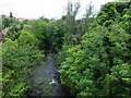
The River South Esk
Viewed from the bridge on Newmills Road (the A6106). Depressing amount of rubbish (mattress, shopping trolley, kids' bikes) in the water immediately below the bridge.
Image: © Barbara Carr
Taken: 2 Jul 2013
0.07 miles
7
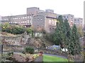
Dalkeith High School
Just a part of this disused school, that has been boarded up for years.
Image: © M J Richardson
Taken: 6 Nov 2008
0.07 miles
8

Archview Lodge Nursing Home
Just to the south of Newmills Road (the A6106).
Image: © Barbara Carr
Taken: 2 Jul 2013
0.08 miles

10

Co-Op Clock Tower
The Flemish-style clock tower tops what used to be the Co-Operative Society building, dating from 1887 and designed by J W Maclean, probably James White Maclean, who was born in Dalkeith in 1861.
Image: © Anne Burgess
Taken: 10 Oct 2018
0.19 miles