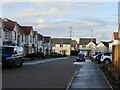
IMAGES TAKEN NEAR TO
Shavelin Drive, MUSSELBURGH, EH21 8SS
Introduction
This page details the photographs taken nearby to Shavelin Drive, EH21 8SS by members of the Geograph project.
The Geograph project started in 2005 with the aim of publishing, organising and preserving representative images for every square kilometre of Great Britain, Ireland and the Isle of Man.

There are currently over 7.5m images from over14,400 individuals and you can help contribute to the project by visiting https://www.geograph.org.uk
Image Map
Images are licensed for reuse under creativecommons.org/licenses/by-sa/2.0
Notes
- Clicking on the map will re-center to the selected point.
- The higher the marker number, the further away the image location is from the centre of the postcode.
Image Listing (118 Images Found)
Images are licensed for reuse under creativecommons.org/licenses/by-sa/2.0
Image
Details
Distance
1

Helen Crummy Way
Newly completed houses in Newcraighall.
Image: © Richard Webb
Taken: 30 Dec 2022
0.03 miles
2

Shavelin Drive
A new bit of Newcraighall.
Image: © Richard Webb
Taken: 30 Dec 2022
0.04 miles
3

Landscaping, Newcraighall
Probably an open space.
Image: © Richard Webb
Taken: 30 Dec 2022
0.05 miles
4

New houses, Newcraighall
Water is flowing from waterlogged ground in a yet undeveloped area of land to the south, towards Queen Margaret University.
Image: © Richard Webb
Taken: 30 Dec 2022
0.06 miles
5

Road to nowhere?
Water pours through the bank at the edge of a housing development. This is a local authority march and East Lothian is flooding The City of Edinburgh. Taken blind over the top of a Heras fence.
Image: © Richard Webb
Taken: 30 Dec 2022
0.06 miles
6

Bill Douglas Grove
Overlooking the football park.
Image: © Richard Webb
Taken: 30 Dec 2022
0.06 miles
7

Scrub succession on land awaiting development
Image: © Richard Webb
Taken: 3 Jan 2021
0.07 miles
8

Flooded road, Middleton Avenue
The road had not yet been completed leaving a drain above a partially surfaced area which filled with water flowing from the disused field behind the houses on the right.
Image: © Richard Webb
Taken: 30 Dec 2022
0.07 miles