
IMAGES TAKEN NEAR TO
Macbeth Moir Road, MUSSELBURGH, EH21 8ET
Introduction
This page details the photographs taken nearby to Macbeth Moir Road, EH21 8ET by members of the Geograph project.
The Geograph project started in 2005 with the aim of publishing, organising and preserving representative images for every square kilometre of Great Britain, Ireland and the Isle of Man.

There are currently over 7.5m images from over14,400 individuals and you can help contribute to the project by visiting https://www.geograph.org.uk
Image Map
Images are licensed for reuse under creativecommons.org/licenses/by-sa/2.0
Notes
- Clicking on the map will re-center to the selected point.
- The higher the marker number, the further away the image location is from the centre of the postcode.
Image Listing (57 Images Found)
Images are licensed for reuse under creativecommons.org/licenses/by-sa/2.0
Image
Details
Distance

3
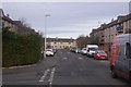
Delta Road, Pinkie Braes
No other letters or geographical features are named around here, but there are lots of Deltas. A local company active once?
Image: © Richard Webb
Taken: 19 Nov 2017
0.08 miles
4

Pinkie Braes
Skate park off Haddington Road, Musselburgh.
Image: © Richard Webb
Taken: 23 Jan 2007
0.08 miles

6
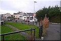
Shops, Pinkie Braes
On Delta Drive, edge of Musselburgh.
Image: © Richard Webb
Taken: 19 Nov 2017
0.10 miles

8

Skate park, Pinkie Braes
In 1976 there was an almighty stushie about the menace of skateboarding. The hate press were printing rubbish condemning it daily. It was a craze, and it would go away.
We are still waiting.
Image: © Richard Webb
Taken: 23 Jan 2007
0.11 miles
9
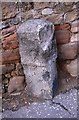
Old Milestone by the A199, Haddington Road, Pinkie Braes, Inveresk Parish
By the A199 (Former A1), in parish of Inveresk (East Lothian District), Levenhall, Pinkie Brae, set in red sandstone wall opposite Moir Place, North East side of road.
Inscription once read:- : E(dinburgh) 7 : : (Haddington) 10 :
Carved bench mark and rivet on top.
Surveyed
Milestone Society National ID: EL_EDHDA07
Image: © Milestone Society
Taken: Unknown
0.11 miles
10

Haddington Road, Musselburgh
Walking along Haddington Road, Musselburgh. Early finishers from the half marathon which finished on the playing fields of Pinkie St Peters Primary School are walking towards the park and ride car park at Wallyford for transport back to Edinburgh. Because of the days event road cones line the roadside indicating the temporary prohibition of parking.
Image: © Graham Robson
Taken: 25 May 2014
0.11 miles