
IMAGES TAKEN NEAR TO
LOANHEAD, EH20 9SS
Introduction
This page details the photographs taken nearby to EH20 9SS by members of the Geograph project.
The Geograph project started in 2005 with the aim of publishing, organising and preserving representative images for every square kilometre of Great Britain, Ireland and the Isle of Man.

There are currently over 7.5m images from over14,400 individuals and you can help contribute to the project by visiting https://www.geograph.org.uk
Image Map
Images are licensed for reuse under creativecommons.org/licenses/by-sa/2.0
Notes
- Clicking on the map will re-center to the selected point.
- The higher the marker number, the further away the image location is from the centre of the postcode.
Image Listing (28 Images Found)
Images are licensed for reuse under creativecommons.org/licenses/by-sa/2.0
Image
Details
Distance
1

Edgefield Industrial Estate.
This square contains many industrial units on old coal mine land. This is one of them down an old mine access road.
Image: © Richard Webb
Taken: 12 Jul 2005
0.11 miles
2
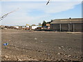
Edgefield Toll Farm
Buildings and surrounding ground that look as if they are being cleared for the development of an industrial estate.
Image: © M J Richardson
Taken: 7 Oct 2014
0.11 miles
3

Edgefield
Scenery beside the Loanhead railway path.
Image: © Richard Webb
Taken: 24 Aug 2015
0.12 miles

5
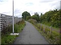
Edinburgh, Loanhead and Roslin Railway
The line to Penicuik lasted until the 1980s as a mineral railway for the Bilston Glen Colliery. Now it is a cycle path.
Image: © Richard Webb
Taken: 24 Aug 2015
0.13 miles
6
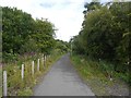
Edinburgh, Loanhead and Roslin Railway
Still mapped as a railway, it has been disused since the Bilston Glen Colliery closed. The tracks have been lifted, lighting put in and it is now a cycle path.
Image: © Richard Webb
Taken: 24 Aug 2015
0.14 miles
7
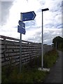
Signpost, Loanhead railway paths
A path signpost where there was once a railway junction. A mineral line left the Edinburgh, Loanhead and Roslin Railway here for the Pentland Oil Works (where Straiton Retail Park is today).
Image: © Richard Webb
Taken: 24 Aug 2015
0.14 miles
8

Shawfair to Loanhead cycle path, Edgefield
Using the Bilston Glen Colliery railway trackbed.
Image: © Richard Webb
Taken: 31 May 2020
0.15 miles
9

Cycle path near Edinburgh City By-Pass
The route of the old Loanhead to Monktonhall railway line, here tarmaced as far as the bridge under the A720 by-pass. Beyond here the trackbed is grass or gravel.
Image: © Jim Barton
Taken: 24 Feb 2012
0.16 miles
10
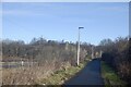
Roslin cycle path
Bilston Glen Colliery's mineral line climbing into Loanhead.
Image: © Richard Webb
Taken: 17 Feb 2021
0.16 miles