
IMAGES TAKEN NEAR TO
Hunter Avenue, LOANHEAD, EH20 9SN
Introduction
This page details the photographs taken nearby to Hunter Avenue, EH20 9SN by members of the Geograph project.
The Geograph project started in 2005 with the aim of publishing, organising and preserving representative images for every square kilometre of Great Britain, Ireland and the Isle of Man.

There are currently over 7.5m images from over14,400 individuals and you can help contribute to the project by visiting https://www.geograph.org.uk
Image Map
Images are licensed for reuse under creativecommons.org/licenses/by-sa/2.0
Notes
- Clicking on the map will re-center to the selected point.
- The higher the marker number, the further away the image location is from the centre of the postcode.
Image Listing (24 Images Found)
Images are licensed for reuse under creativecommons.org/licenses/by-sa/2.0
Image
Details
Distance


3
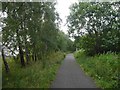
Edinburgh, Loanhead and Roslin Railway
After passenger services stopped the railway continued as a mineral line for Bilston Glen colliery. Now the trackbed is tarred as a cycle path.
Image: © Richard Webb
Taken: 24 Aug 2015
0.08 miles
4

Industrial premises, Loanhead
By the cycleway and footpath on the former railway line on a frosty morning.
Image: © Jim Barton
Taken: 6 Dec 2011
0.11 miles
5
![Loanhead Drill Hall [north] - site of](https://s2.geograph.org.uk/geophotos/04/05/02/4050266_3d5cd37c_120x120.jpg)
Loanhead Drill Hall [north] - site of
The site of a WW1 drill hall that no longer survives. 6 Academy Lane was the base for 8th Battalion, Royal Scots (F Company) Lothian and Border Horse (B Squadron) drill station. http://www.geograph.org.uk/article/WW1-Great-War-Centenary---Drill-Halls/18#lothians . There appear to have been two drill halls. The first [south] appears on an 1895 OS Map, labelled as such, on the corner of High Street and Lasswade Road. It was demolished after the 3rd edition of the 1:25000 map. It was replaced in 1910 by another hall to the north [on the site now occupied by these new houses, which are about three years old], and in use as a drill hall until about 1923, when it was acquired by the council and used as a community hall; it then apparently became the town hall. It was reportedly refurbished in 1974, but is clearly not there now; I have so far been unable to discover when it was demolished. It was still there in March 2009 https://www.google.co.uk/maps/@55.878074,-3.145525,3a,75y,11.29h,88.6t/data=!3m5!1e1!3m3!1swbXH-P60yUt-e7Aaq3wVng!2e0!5s2009-03 , but had gone by Nov. 2010, and the houses were being built https://www.google.co.uk/maps/@55.877995,-3.145489,3a,75y,11.29h,88.6t/data=!3m5!1e1!3m3!1s8rnUh9wYgh8ZT3deMhN_dw!2e0!5s2010-11.
Image: © M J Richardson
Taken: 30 Jun 2014
0.13 miles
6
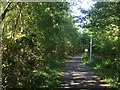
Cyclepath, Loanhead
On the trackbed of the Bilston Colliery railway, this was opened earlier than the section around Gilmerton.
Image: © Richard Webb
Taken: 31 May 2020
0.13 miles
7

Entrance to Mavis Bank Grange
A courtyard development of modern housing on the outskirts of Loanhead
Image: © Tom Richardson
Taken: 23 Jun 2011
0.14 miles
8
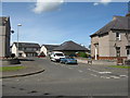
Academy Lane, Loanhead
The site of a WW1 drill hall that no longer survives. 6 Academy Lane was the base for 8th Battalion, Royal Scots (F Company) Lothian and Border Horse (B Squadron) drill station. http://www.geograph.org.uk/article/WW1-Great-War-Centenary---Drill-Halls/18#lothians . There appear to have been two drill halls. The first [south] appears on an 1895 OS Map, labelled as such, on the corner of High Street and Lasswade Road [at the right of this picture]. It was demolished after the 3rd edition of the 1:25000 map. It was replaced in 1910 by another hall to the north [on the site now occupied by the new houses by the red car], and in use as a drill hall until about 1923, when it was acquired by the council and used as a community hall; it then apparently became the town hall. It was reportedly refurbished in 1974, but is clearly not there now; I have so far been unable to discover when it was demolished, but it was still there in March 2009 https://www.google.co.uk/maps/@55.878074,-3.145525,3a,75y,11.29h,88.6t/data=!3m5!1e1!3m3!1swbXH-P60yUt-e7Aaq3wVng!2e0!5s2009-03, but had gone, and the houses were being built by Nov. 2010.
Image: © M J Richardson
Taken: 30 Jun 2014
0.16 miles
9

Nearly through Loanhead.
The road running through the east end of the village.
Image: © James Denham
Taken: 11 Oct 2008
0.16 miles
10

Linden Cottage in Loanhead
The blue plaque on this cottage records the fact that the explorer and botanist George Forrest (1873-1932) left it in 1904 at the start of his first expedition to China, where he spent 17 years as a botanical collector. It also mentions that plants collected by him carry the botanical name Forrestii.
Image: © Morley Sewell
Taken: 3 Aug 2009
0.16 miles