
IMAGES TAKEN NEAR TO
High Street, LOANHEAD, EH20 9RW
Introduction
This page details the photographs taken nearby to High Street, EH20 9RW by members of the Geograph project.
The Geograph project started in 2005 with the aim of publishing, organising and preserving representative images for every square kilometre of Great Britain, Ireland and the Isle of Man.

There are currently over 7.5m images from over14,400 individuals and you can help contribute to the project by visiting https://www.geograph.org.uk
Image Map
Images are licensed for reuse under creativecommons.org/licenses/by-sa/2.0
Notes
- Clicking on the map will re-center to the selected point.
- The higher the marker number, the further away the image location is from the centre of the postcode.
Image Listing (59 Images Found)
Images are licensed for reuse under creativecommons.org/licenses/by-sa/2.0
Image
Details
Distance
1

Mavis Bank Grange
A new 9-house 'courtyard' development on the north side of Lasswade Road [the A768] in Loanhead.
Image: © M J Richardson
Taken: 23 Feb 2011
0.03 miles
2

Decorative railings, High Street, Loanhead
Near the site of the old railway station and town centre there are some fine examples of decorative street furniture - seats, railings, tree protectors and sculpture.
Image: © M J Richardson
Taken: 2 Sep 2008
0.04 miles
3

Man, boy and horse at Loanhead
Presumably miner and pit pony, but no information on the work except that it was sculpted by Alan Heriot [sic - it should be Herriot] 1987, and was commissioned by Loanhead & District Community Council.
Image: © M J Richardson
Taken: 24 Nov 2010
0.04 miles
4

Arbuthnot Road, Loanhead
Looking north towards the High Street, a mixture of housing and architectural styles.
Image: © M J Richardson
Taken: 23 Feb 2011
0.05 miles


7

Linden Cottage in Loanhead
The blue plaque on this cottage records the fact that the explorer and botanist George Forrest (1873-1932) left it in 1904 at the start of his first expedition to China, where he spent 17 years as a botanical collector. It also mentions that plants collected by him carry the botanical name Forrestii.
Image: © Morley Sewell
Taken: 3 Aug 2009
0.06 miles
8
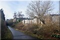
Bilston Glen Colliery's mineral line
Now a cycle path between Shawfair and Roslin.
Image: © Richard Webb
Taken: 17 Feb 2021
0.06 miles
9

Path junction, Loanhead
Looking from the side path to Lasswade to the old railway path between Straiton (R) and Roslin (L). The symbol on top of the signpost indicates the Rosslyn Chapel Way.
Image: © Jim Barton
Taken: 6 Feb 2019
0.06 miles
