
IMAGES TAKEN NEAR TO
Mayburn Avenue, LOANHEAD, EH20 9EL
Introduction
This page details the photographs taken nearby to Mayburn Avenue, EH20 9EL by members of the Geograph project.
The Geograph project started in 2005 with the aim of publishing, organising and preserving representative images for every square kilometre of Great Britain, Ireland and the Isle of Man.

There are currently over 7.5m images from over14,400 individuals and you can help contribute to the project by visiting https://www.geograph.org.uk
Image Map
Images are licensed for reuse under creativecommons.org/licenses/by-sa/2.0
Notes
- Clicking on the map will re-center to the selected point.
- The higher the marker number, the further away the image location is from the centre of the postcode.
Image Listing (16 Images Found)
Images are licensed for reuse under creativecommons.org/licenses/by-sa/2.0
Image
Details
Distance
1

Hawthorn Gardens, Loanhead Road - B702
Image: © M J Richardson
Taken: 2 Sep 2008
0.09 miles
2

Hawthorn Gardens
A real mixter-maxter of building styles, currently under renovation by the look of things.
Image: © Anne Burgess
Taken: 4 Nov 2017
0.12 miles
3

Residential area near Loanhead
A housing development situated between the Straiton Retail Park and the village of Loanhead.
Image: © Jim Barton
Taken: 14 Feb 2013
0.16 miles
4

Building site preparation, Loanhead
Land on the southeast side of the May Burn is being prepared for building.
Image: © Jim Barton
Taken: 6 Feb 2019
0.16 miles
5

Paradykes Primary School, Loanhead
A big school for small children: part of the Loanhead Centre which brings together on one site the school, leisure centre and swimming pool, library and medical centre. The complex opened in August 2017.
Image: © Jim Barton
Taken: 6 Feb 2019
0.17 miles
6

New houses, Loanhead Road
A new housing development by the B702 at Mayburn Park.
Image: © Jim Barton
Taken: 6 Feb 2019
0.18 miles
7

Fountain Place, Loanhead
Approaching the junction with Edgefield Road.
Image: © Andrew Abbott
Taken: 12 Nov 2022
0.19 miles
8

The May Burn near Loanhead
The trees have been planted on the edge of The Mayburn Park housing development, and it appears that the land on the opposite bank is being cleared for development also.
Image: © Jim Barton
Taken: 6 Feb 2019
0.19 miles
9

Loanhead Centre
The central part of a community development opened in 2017 comprising a primary school, leisure centre, swimming pool, library and medical centre.
Image: © Jim Barton
Taken: 6 Feb 2019
0.20 miles
10
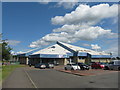
Loanhead Leisure Centre
With summer clouds.
Image: © M J Richardson
Taken: 30 Jun 2014
0.21 miles