
IMAGES TAKEN NEAR TO
Mayflower Gardens, LOANHEAD, EH20 9DH
Introduction
This page details the photographs taken nearby to Mayflower Gardens, EH20 9DH by members of the Geograph project.
The Geograph project started in 2005 with the aim of publishing, organising and preserving representative images for every square kilometre of Great Britain, Ireland and the Isle of Man.

There are currently over 7.5m images from over14,400 individuals and you can help contribute to the project by visiting https://www.geograph.org.uk
Image Map
Images are licensed for reuse under creativecommons.org/licenses/by-sa/2.0
Notes
- Clicking on the map will re-center to the selected point.
- The higher the marker number, the further away the image location is from the centre of the postcode.
Image Listing (34 Images Found)
Images are licensed for reuse under creativecommons.org/licenses/by-sa/2.0
Image
Details
Distance
1
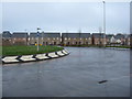
New houses at Loanhead
Ashgrove Fields, one of two large housing developments, by Cala and Taylor Wimpey, on the northern edge of Loanhead, served by the new Edgefield Relief Road. When finished there will be 205 2-5 bedroom houses.
Image: © M J Richardson
Taken: 7 Feb 2017
0.08 miles
2

Brand-new Houses
This street at Edgefield is so new that the developers have yet to sort out the garden ground. They would have a fine view of one of the untidier units in the industrial estate were it not for a high wooden fence just out of sight on the left in this view.
Image: © Anne Burgess
Taken: 4 Nov 2017
0.09 miles

4
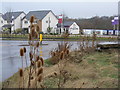
New housing at Loanhead
Ashgrove Fields, one of two large housing developments, by Cala and Taylor Wimpey, on the northern edge of Loanhead, served by the new Edgefield Relief Road. When finished there will be 205 2-5 bedroom houses.
Image: © M J Richardson
Taken: 7 Feb 2017
0.13 miles
5

Hawthorn Gardens
A real mixter-maxter of building styles, currently under renovation by the look of things.
Image: © Anne Burgess
Taken: 4 Nov 2017
0.16 miles
6

Building site preparation, Loanhead
Land on the southeast side of the May Burn is being prepared for building.
Image: © Jim Barton
Taken: 6 Feb 2019
0.17 miles
7

The May Burn near Loanhead
The trees have been planted on the edge of The Mayburn Park housing development, and it appears that the land on the opposite bank is being cleared for development also.
Image: © Jim Barton
Taken: 6 Feb 2019
0.17 miles
8

Edgefield Industrial Estate
This is one of the units in the industrial estate, and it was conspicuously lacking in anything to say what it is used for. I did eventually find a shy little sign saying 'Noble Foods' but on checking that company's web site, they don't have a presence in Loanhead. Further investigation revealed that this was a Noble Foods egg processing factory, and that it was closed in 2010 with the loss of 90 jobs. I suppose the company must have overlooked removing that shy little sign. I would be intrigued to know why processing eggs required no less than four tall silos.
Image: © Anne Burgess
Taken: 4 Nov 2017
0.17 miles
9

Hawthorn Gardens, Loanhead Road - B702
Image: © M J Richardson
Taken: 2 Sep 2008
0.18 miles
