
IMAGES TAKEN NEAR TO
Hazel Drive, BONNYRIGG, EH19 3EJ
Introduction
This page details the photographs taken nearby to Hazel Drive, EH19 3EJ by members of the Geograph project.
The Geograph project started in 2005 with the aim of publishing, organising and preserving representative images for every square kilometre of Great Britain, Ireland and the Isle of Man.

There are currently over 7.5m images from over14,400 individuals and you can help contribute to the project by visiting https://www.geograph.org.uk
Image Map
Images are licensed for reuse under creativecommons.org/licenses/by-sa/2.0
Notes
- Clicking on the map will re-center to the selected point.
- The higher the marker number, the further away the image location is from the centre of the postcode.
Image Listing (18 Images Found)
Images are licensed for reuse under creativecommons.org/licenses/by-sa/2.0
Image
Details
Distance
1
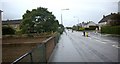
Still in Bonnyrigg.
Passing the Hopefield estate heading for Rosewell.
Image: © James Denham
Taken: 4 Oct 2008
0.04 miles
2
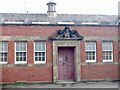
Former school building, Bonnyrigg
Most of the buildings on the site have been demolished.
Image: © Richard Webb
Taken: 18 Mar 2023
0.11 miles
4
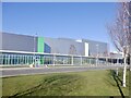
Lasswade High School
The new building on Eskdale Drive.
Image: © Richard Webb
Taken: 11 Apr 2021
0.14 miles
5
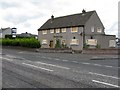
Staiside Inn at Bonnyrigg
One of many 'dead' pubs around the Lothians
Image: © M J Richardson
Taken: 10 Sep 2009
0.17 miles

7

Peebles Railway
Now a cycle path, this was once a railway to Galashiels via Peebles with a branch to Penicuik.
Image: © Richard Webb
Taken: 25 Sep 2011
0.19 miles
8

Cycleway, Bonnyrigg
An access point to the footpath and cycleway between Penicuik (R) and Dalkeith (L) on the route of the former railway line.
Image: © Jim Barton
Taken: 5 Feb 2015
0.19 miles
9

Auld Coal Road, Bonnyrigg
Part of a large early 21st century housing development south of Bonnyrigg.
Image: © Richard Webb
Taken: 9 May 2020
0.19 miles
10

New houses, Bonnyrigg
Construction of houses on the land between Bonnyrigg and the new bypass. Bonnyrigg is expanding rapidly southwards.
Image: © Richard Webb
Taken: 25 Sep 2011
0.19 miles