
IMAGES TAKEN NEAR TO
Burdiehouse Street, EDINBURGH, EH17 8HF
Introduction
This page details the photographs taken nearby to Burdiehouse Street, EH17 8HF by members of the Geograph project.
The Geograph project started in 2005 with the aim of publishing, organising and preserving representative images for every square kilometre of Great Britain, Ireland and the Isle of Man.

There are currently over 7.5m images from over14,400 individuals and you can help contribute to the project by visiting https://www.geograph.org.uk
Image Map
Images are licensed for reuse under creativecommons.org/licenses/by-sa/2.0
Notes
- Clicking on the map will re-center to the selected point.
- The higher the marker number, the further away the image location is from the centre of the postcode.
Image Listing (25 Images Found)
Images are licensed for reuse under creativecommons.org/licenses/by-sa/2.0
Image
Details
Distance
1

Path alongside the Burdiehouse Burn
A path in the Burdiehouse Burn Valley Park east of Straiton Road.
Image: © Jim Barton
Taken: 8 Feb 2018
0.10 miles
2
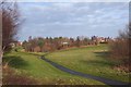
Paths in Burdiehouse Burn Valley Park
The park follows the burn NE. Its name changes to the Niddrie Burn and finally the Brunstane Burn before it reaches the coast near Musselburgh.
Image: © Jim Barton
Taken: 8 Feb 2018
0.10 miles
3

Housing development, Burdiehouse
Houses under construction at Kilns Gait and The Limes developments on the southern fringe of Edinburgh. The names recall the limestone workings and limekilns that were common here at one time - see Image
Image: © Jim Barton
Taken: 8 Feb 2018
0.13 miles
4

Burdiehouse Village
Village on the edge of Edinburgh. It's not quite swallowed up, but the southern housing developments of the city are very close. As well as these older houses there is some mid 20th Century municipal housing.
Image: © Richard Webb
Taken: 4 Jun 2005
0.15 miles
5

Burdiehouse Terrace
Postwar housing development on the southern edge of Edinburgh.
Image: © Richard Webb
Taken: 29 Dec 2023
0.15 miles
6
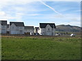
New houses at Burdiehouse
On the site of Burdiehouse Farm - land that was Green Belt, released for development. Beyond are the Pentland Hills at Fairmilehead.
Image: © M J Richardson
Taken: 20 Mar 2019
0.17 miles
7

Path in Burdiehouse Burn Valley Park
The name 'Burdiehouse' is said to have been a corruption of Bordeaux House, after French ladies-in-waiting who in the mid-16th century lived there in service to Mary Queen of Scots at Craigmillar Castle. More recently, Burdiehouse was an area of limestone workings and shale oil extraction. (From 'The Villages of Edinburgh' vol. 2 by Malcolm Cant, John Donald 1987).
Image: © Jim Barton
Taken: 8 Feb 2018
0.17 miles

9

Edinburgh expanding southwards
The signboard announcing a new housing development on a very large site now being prepared the west of Straiton Road at Burdiehouse.
Image: © Jim Barton
Taken: 8 Feb 2018
0.19 miles
