
IMAGES TAKEN NEAR TO
Upper Craigour Way, EDINBURGH, EH17 7SG
Introduction
This page details the photographs taken nearby to Upper Craigour Way, EH17 7SG by members of the Geograph project.
The Geograph project started in 2005 with the aim of publishing, organising and preserving representative images for every square kilometre of Great Britain, Ireland and the Isle of Man.

There are currently over 7.5m images from over14,400 individuals and you can help contribute to the project by visiting https://www.geograph.org.uk
Image Map
Images are licensed for reuse under creativecommons.org/licenses/by-sa/2.0
Notes
- Clicking on the map will re-center to the selected point.
- The higher the marker number, the further away the image location is from the centre of the postcode.
Image Listing (102 Images Found)
Images are licensed for reuse under creativecommons.org/licenses/by-sa/2.0
Image
Details
Distance
1

Upper Craigour
Almost all of this square is occupied by the Royal Infirmary, but this little corner is made up of low-rise housing with absolutely no parking at all except for residents. This, presumably, is to prevent it being overrun with people going to the Infirmary.
Image: © Anne Burgess
Taken: 1 Mar 2017
0.02 miles
2

Shops: Moredunvale
Nearest tower block is within the square
Image: © Jim Smillie
Taken: 14 Sep 2023
0.04 miles
3

Burdiehouse Burn at Little France
With Buddleja on the left and the sickly sweet smelling Himalayan Balsam, an invasive introduction along many watercourses, on the right.
Image: © M J Richardson
Taken: 30 Jul 2008
0.06 miles
4
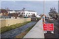
Flood works on the Burdiehouse Burn, Little France
A flood protection wall under construction near the A7 close to the new Edinburgh Royal Infirmary site. Note the mis-spelling of 'Dalkeith' on the sign.
Image: © Jim Barton
Taken: 8 Feb 2018
0.06 miles
5

Burdiehouse Burn Flood Protection Works
Built to protect the new Royal Hospital for Sick Children and Department of Clinical Neurosciences Buildings at Little France.
Image: © Graeme Yuill
Taken: 5 Mar 2016
0.06 miles
6

Burdiehouse Burn
With almost-completed flood prevention works. The multi-storey blocks are at Craigour.
Image: © M J Richardson
Taken: 28 Jun 2018
0.06 miles
7

Burdiehouse Burn Flood Protection Works
Built to protect the new Royal Hospital for Sick Children and Department Clinical Neurosciences at Little France
Image: © Graeme Yuill
Taken: 5 Mar 2016
0.06 miles
8
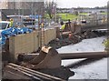
Flood protection work, Little France Edinburgh
A flood protection wall under construction by the Burdiehouse Burn, seen from the A7.
Image: © Jim Barton
Taken: 8 Feb 2018
0.07 miles
9

Tower blocks, Moredun
Castleview House, Little France House, Marytree House and Moredun House (left to right)
Image: © Richard Webb
Taken: 6 Mar 2023
0.07 miles
10

Tower Blocks
These are four of the six fifteen-storey blacks of flats at Moredun. The nearest one is in this square but the rest are in the next square.
Image: © Anne Burgess
Taken: 1 Mar 2017
0.08 miles