
IMAGES TAKEN NEAR TO
Captains Drive, EDINBURGH, EH16 6QW
Introduction
This page details the photographs taken nearby to Captains Drive, EH16 6QW by members of the Geograph project.
The Geograph project started in 2005 with the aim of publishing, organising and preserving representative images for every square kilometre of Great Britain, Ireland and the Isle of Man.

There are currently over 7.5m images from over14,400 individuals and you can help contribute to the project by visiting https://www.geograph.org.uk
Image Map
Images are licensed for reuse under creativecommons.org/licenses/by-sa/2.0
Notes
- Clicking on the map will re-center to the selected point.
- The higher the marker number, the further away the image location is from the centre of the postcode.
Image Listing (63 Images Found)
Images are licensed for reuse under creativecommons.org/licenses/by-sa/2.0
Image
Details
Distance
3
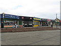
Tartan Tandoori - shops at Gracemount
On Captain's Road at its junction with Gracemount Drive. Of the six shops in view the five on the right are also visible in Richard Webb's 2005 image Image From the left #2 was a different hairdressers/tanning studio; #3 the Tartan Tandoori is new; #4 is still a bakers, but with a new name; #5 has become a sign shop; and #6 is a solicitors' office. So possibly 100% turnover in 7 years and quite considerable change of use.
Image: © M J Richardson
Taken: 12 Mar 2012
0.07 miles
4
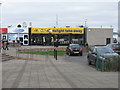
Fryer's delight at Gracemount
One of several food outlets in this small group of shops, doing a good trade at lunchtime, with schools around, and catering for the typical healthy scottish youth diet, e.g. pizza and chips. It was there in 2005 Image, but has had a makeover.
Image: © M J Richardson
Taken: 12 Mar 2012
0.08 miles
5
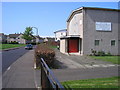
Gracemount Drive and Kaimes Lockhart Memorial Church
Kaimes Lockhart Memorial Parish Church is on the right. Previously this church was Burdiehouse Parish Church.
Image: © Sandy Gemmill
Taken: 27 Apr 2007
0.09 miles
6
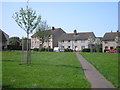
Balm Well Park and St Katherine's Loan
The footpath across the grass parkland in front of houses in Balm Well Park and St Katherine's Loan.
Image: © Sandy Gemmill
Taken: 27 Apr 2007
0.09 miles

9
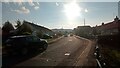
Balmwell Terrace - A Street with a View
The hills below the bright evening sun at the end of this suburban street are at the NorthEastern edge of the Pentlands, and are about two miles from here as the crow flies.
The left side of the street is made up entirely of bungalows, which although not 'old' old, have certainly been around for a while. On the right side of the street the bungalows quickly give way to a new housing association low-flat development, completed around 2015. This is followed by a small cul-de-sac leading to what looked to be one bedroom council bungalows; these are all still part of Balmwell Terrace.
Whilst I have to admit I am secretly a bit of a fan of these new blocks, with their square sides and different coloured bricks, I do think that the architect's blurb (this comes up near the top of the listings when an online search is done for the street), which boasts about "strong repeating patterns", is pushing things a bit! And the top floor of the block, set back a bit further from the street, is just weird - it looks like the walls are made from sheet steel.
The street gets its name from a nearby old well - access to which is through a pub beer garden - which is labelled 'St Katherine's or Oily Well' in Gothic typeface on the OS maps. However, although there are several nearby street names that begin with 'St Katherine's', the only ones that reference the well are the Balmwells, of which they are a few. The 'Balm' part has something to do with the supposedly healing qualities of the water drawn up through it. In reality though it probably just meant that you didn't die from drinking it. I'm pretty sure that all the water in Edinburgh was so polluted at the time the well came along that the population there had to drink beer all day long in order to to stay alive.
Image: © Ian Dodds
Taken: 20 Sep 2022
0.11 miles
10
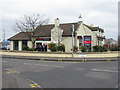
Tesco Express - Gracemount
On Captain's Road/Gracemount Drive. This was The Marmion pub, closed for sometime and now converted to a mini-supermarket.
Image: © M J Richardson
Taken: 12 Mar 2012
0.11 miles