
IMAGES TAKEN NEAR TO
Balmwell Grove, EDINBURGH, EH16 6HB
Introduction
This page details the photographs taken nearby to Balmwell Grove, EH16 6HB by members of the Geograph project.
The Geograph project started in 2005 with the aim of publishing, organising and preserving representative images for every square kilometre of Great Britain, Ireland and the Isle of Man.

There are currently over 7.5m images from over14,400 individuals and you can help contribute to the project by visiting https://www.geograph.org.uk
Image Map
Images are licensed for reuse under creativecommons.org/licenses/by-sa/2.0
Notes
- Clicking on the map will re-center to the selected point.
- The higher the marker number, the further away the image location is from the centre of the postcode.
Image Listing (73 Images Found)
Images are licensed for reuse under creativecommons.org/licenses/by-sa/2.0
Image
Details
Distance
1
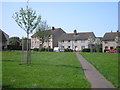
Balm Well Park and St Katherine's Loan
The footpath across the grass parkland in front of houses in Balm Well Park and St Katherine's Loan.
Image: © Sandy Gemmill
Taken: 27 Apr 2007
0.00 miles
2
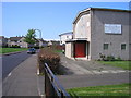
Gracemount Drive and Kaimes Lockhart Memorial Church
Kaimes Lockhart Memorial Parish Church is on the right. Previously this church was Burdiehouse Parish Church.
Image: © Sandy Gemmill
Taken: 27 Apr 2007
0.00 miles
5
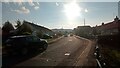
Balmwell Terrace - A Street with a View
The hills below the bright evening sun at the end of this suburban street are at the NorthEastern edge of the Pentlands, and are about two miles from here as the crow flies.
The left side of the street is made up entirely of bungalows, which although not 'old' old, have certainly been around for a while. On the right side of the street the bungalows quickly give way to a new housing association low-flat development, completed around 2015. This is followed by a small cul-de-sac leading to what looked to be one bedroom council bungalows; these are all still part of Balmwell Terrace.
Whilst I have to admit I am secretly a bit of a fan of these new blocks, with their square sides and different coloured bricks, I do think that the architect's blurb (this comes up near the top of the listings when an online search is done for the street), which boasts about "strong repeating patterns", is pushing things a bit! And the top floor of the block, set back a bit further from the street, is just weird - it looks like the walls are made from sheet steel.
The street gets its name from a nearby old well - access to which is through a pub beer garden - which is labelled 'St Katherine's or Oily Well' in Gothic typeface on the OS maps. However, although there are several nearby street names that begin with 'St Katherine's', the only ones that reference the well are the Balmwells, of which they are a few. The 'Balm' part has something to do with the supposedly healing qualities of the water drawn up through it. In reality though it probably just meant that you didn't die from drinking it. I'm pretty sure that all the water in Edinburgh was so polluted at the time the well came along that the population there had to drink beer all day long in order to to stay alive.
Image: © Ian Dodds
Taken: 20 Sep 2022
0.09 miles
6
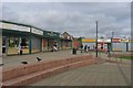
Shops, Gracemount
Local shops for a 1960s-ish housing scheme in South Edinburgh. Rooks are clearing up the previous night's discarded fast food.
Image: © Richard Webb
Taken: 4 Jun 2005
0.09 miles
7
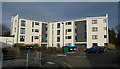
Four storey residential block
Part of the Dunedin Canmore Housing Association estate replacing Edinburgh City Council workshops. Electricity and hot water are provided by a CHP system burning wood chips, though the power plant requires electricity from the main to operate. The power plant is to the left of the structure, the two aluminium flues being visible.
Image: © roderick hart
Taken: 31 Jan 2009
0.09 miles
8
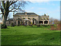
The Balmwell Hotel
The hotel is so called because the grounds contain the Balm Well of St Catherine which was claimed to have healing powers. The masonry of the well itself is small in scale and not visible in this picture. The hotel is now run as a restaurant and bar.
Image: © roderick hart
Taken: 2 Apr 2005
0.09 miles
9
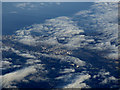
South Edinburgh from the air
Liberton and Gracemount are in the foreground. The six towerblocks near the centre are at Moredun, near the Royal Infirmary. Portobello and Musselburgh are obscured by cloud.
Image: © Thomas Nugent
Taken: 4 Dec 2016
0.09 miles
