
IMAGES TAKEN NEAR TO
Carnbee End, EDINBURGH, EH16 6GJ
Introduction
This page details the photographs taken nearby to Carnbee End, EH16 6GJ by members of the Geograph project.
The Geograph project started in 2005 with the aim of publishing, organising and preserving representative images for every square kilometre of Great Britain, Ireland and the Isle of Man.

There are currently over 7.5m images from over14,400 individuals and you can help contribute to the project by visiting https://www.geograph.org.uk
Image Map
Images are licensed for reuse under creativecommons.org/licenses/by-sa/2.0
Notes
- Clicking on the map will re-center to the selected point.
- The higher the marker number, the further away the image location is from the centre of the postcode.
Image Listing (41 Images Found)
Images are licensed for reuse under creativecommons.org/licenses/by-sa/2.0
Image
Details
Distance
1

Ellen's Glen, Edinburgh
The Burdiehouse Burn on its course towards Gilmerton Road.
Image: © Jim Barton
Taken: 8 Feb 2018
0.05 miles
2

Ellen's Glen House
The new residential hospital built by Lothian NHS in the grounds of Southfield House to provide continuing care for the elderly.
Image: © Kay Williams
Taken: 4 Feb 2008
0.07 miles
3
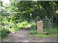
Entrance to Burdiehouse Burn Valley Park at Ellen's Glen
Image: © M J Richardson
Taken: 30 Jul 2008
0.08 miles
4
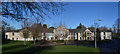
Ellen's Glen House
Ellen’s Glen is a community hospital specialising in providing long-term mental health and palliative care. Ellen’s Glen House is managed by Walker Healthcare and all care services are provided by the NHS.
NHS Lothian: https://www.nhslothian.scot/GoingToHospital/Locations/Pages/EllensGlenHouse.aspx
Image: © Kay Williams
Taken: 4 Feb 2019
0.09 miles
5
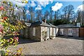
Old toll house
The toll house dating from 1830 on the Lasswade District Tollroad at Mayfield, Craigmillar Park/Lady Road, now A701, was demolished about 1880-1894. It was rebuilt on the west bank of the Burdiehouse Burn in Ellen's Glen Loan.
Image: © John Riddell
Taken: 15 May 2021
0.10 miles
6
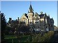
Southfield House
Baronial country house by architect John Chesser dating from 1875. Used as a hospital for many years. In the 1990s a new hospital (Ellen's Glen) and a housing estate (Carnbee) was built in the substantial garden grounds. The house is subdivided to provide a number of dwellings.
Image: © Kay Williams
Taken: 4 Feb 2008
0.10 miles
7
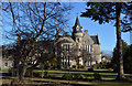
Southfield House
Southfield House is a baronial style mansion house which was designed in 1875 by John Chesser. It became the Royal Victoria Sanatorium. Various ward blocks from the 1920s and 30s were demolished in the 1990s and a new community hospital was built (Ellen's Glen House). The original mansion was sold by the NHS and converted into apartments. The extensive mature grounds was redeveloped as the Carnbee housing estate.
Image: © Kay Williams
Taken: 4 Feb 2019
0.10 miles
8

Hyvots Loan
An old road, now little more than a wider than usual path leads down to Ellen's Glen from Morrisons. To the right is a narrow woodland with a parallel path.
Image: © Richard Webb
Taken: 8 Dec 2019
0.11 miles
9

Houses on Ellen's Glen Loan
These houses are on the south side of the loan, seen through trees
from Burdiehouse Burn Valley Park.
Image: © roderick hart
Taken: 6 Feb 2009
0.12 miles
10

Woodland beside Hyvot's Loan
An extension southwards of Moredun Woods. The path comes out near The Morrisons supermarket.
Image: © Richard Webb
Taken: 8 Dec 2019
0.12 miles