
IMAGES TAKEN NEAR TO
Mansfield Road, BALERNO, EH14 7JT
Introduction
This page details the photographs taken nearby to Mansfield Road, EH14 7JT by members of the Geograph project.
The Geograph project started in 2005 with the aim of publishing, organising and preserving representative images for every square kilometre of Great Britain, Ireland and the Isle of Man.

There are currently over 7.5m images from over14,400 individuals and you can help contribute to the project by visiting https://www.geograph.org.uk
Image Map
Images are licensed for reuse under creativecommons.org/licenses/by-sa/2.0
Notes
- Clicking on the map will re-center to the selected point.
- The higher the marker number, the further away the image location is from the centre of the postcode.
Image Listing (13 Images Found)
Images are licensed for reuse under creativecommons.org/licenses/by-sa/2.0
Image
Details
Distance
1
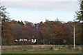
Marchbank House
There's just a glimpse of Marchbank House through the trees.
Image: © Anne Burgess
Taken: 2 Nov 2017
0.05 miles
2

Future Firewood
One or more of the beeches here has fallen or been felled, and the trunk cut into log-sized lengths.
Image: © Anne Burgess
Taken: 2 Nov 2017
0.09 miles
3

Shelter Belt
The trees here have seen better days. If they get much more straggly they won't be providing much in the way of shelter.
Image: © Anne Burgess
Taken: 2 Nov 2017
0.12 miles
4
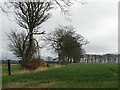
Barley fields, Marchbank
Beeches as field boundary. Near here there is much damp land, but this area is good arable land.
Image: © Richard Webb
Taken: 21 Apr 2007
0.14 miles
5

Shelterbelt and rough grass at Marchbank
Beech and pine are the trees of preference for shelterbelts on these high wet soils.
Image: © M J Richardson
Taken: 1 Oct 2010
0.16 miles
6

Red Moss
Red Moss, white today under deep snow, is an important nature reserve.
East Cairn Hill is in the distance.
Image: © Callum Black
Taken: 3 Jan 2010
0.17 miles
7
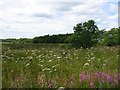
Red Moss
Bog and wet woodland. A Scottish Wildlife Trust managed reserve.
Image: © Richard Webb
Taken: 22 Jul 2005
0.17 miles
8

Dumb Dumpers
Rubbish tipped on the edge of Red Moss. The fact that this is a gateway to a field in use is not a consideration to these lowlives, who may be quite well off - these clippings are from a big hedge in a big garden.
Image: © Richard Webb
Taken: 21 Apr 2007
0.18 miles
9

Red Moss
Heather and scrub woodland covered blanket bog. Run as a wildlife reserve.
Image: © Richard Webb
Taken: 21 Apr 2007
0.19 miles
10

Road from Bavelaw
Crossing Red Moss - a blanket bog.
Image: © Richard Webb
Taken: 31 Jan 2016
0.19 miles