
IMAGES TAKEN NEAR TO
Greenfield Road, BALERNO, EH14 7HB
Introduction
This page details the photographs taken nearby to Greenfield Road, EH14 7HB by members of the Geograph project.
The Geograph project started in 2005 with the aim of publishing, organising and preserving representative images for every square kilometre of Great Britain, Ireland and the Isle of Man.

There are currently over 7.5m images from over14,400 individuals and you can help contribute to the project by visiting https://www.geograph.org.uk
Image Map
Images are licensed for reuse under creativecommons.org/licenses/by-sa/2.0
Notes
- Clicking on the map will re-center to the selected point.
- The higher the marker number, the further away the image location is from the centre of the postcode.
Image Listing (10 Images Found)
Images are licensed for reuse under creativecommons.org/licenses/by-sa/2.0
Image
Details
Distance
1
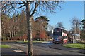
Bus turning circle, Balerno
A Lothian Buses double decker at the end of the service 44 Wallyford to Balerno route.
Image: © Jim Barton
Taken: 3 Dec 2018
0.11 miles

3
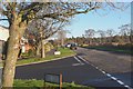
Cockburn Crescent, Balerno
The crescent follows the periphery of the residential area with farmland to the south and west. The junction in the foreground is with Whitelea Road.
Image: © Jim Barton
Taken: 3 Dec 2018
0.13 miles
4
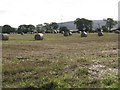
Bales at Balerno
Black Hill, one of the lesser Pentland Hills [501 m], is on the right in the distance.
Image: © M J Richardson
Taken: 1 Oct 2008
0.16 miles
5
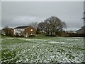
Gala Field, Balerno
View through to Dean Park Primary School.
Image: © Richard Webb
Taken: 31 Jan 2016
0.16 miles
6

The edge of town
Cockburn Crescent, Balerno, the very SW edge of urban and suburban Edinburgh. To the left a gentle climb from farmland to moorland, to the right housing, built over the last 20-30 years, filling in the spaces down to the Water of Leith.
Image: © M J Richardson
Taken: 1 Oct 2008
0.17 miles
7
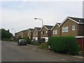
Marchbank Gardens, Balerno.
Balerno housing estate, housing takes up a third of the square.
Image: © Richard Webb
Taken: 31 Aug 2005
0.18 miles
8

Field entrance after harvest
One of many muddy patches on farmland that must be around after this summer's rain. Cockburn Crescent, relatively recent housing on the outskirts of Edinburgh, is on the other side of the hedge.
Image: © M J Richardson
Taken: 1 Oct 2008
0.18 miles
9

Black Hill in view from Balerno
Cockburn Crescent on the SW extremity of Balerno, where housing meets farmland below the Pentland Hills.
Image: © Jim Barton
Taken: 3 Dec 2018
0.24 miles
10

No 44 bus, Balerno
The bus has an unusual livery - normally of course they are maroon. I have moved the location down the road past the bus to avoid classification problems. The bus is on the grid line and is definitely not a ******* "detail".
Hopefully when sanity returns, I can get this back to a good old supplemental image.
Image: © Richard Webb
Taken: 31 Jan 2016
0.24 miles