
IMAGES TAKEN NEAR TO
Ravelrig Road, BALERNO, EH14 7DQ
Introduction
This page details the photographs taken nearby to Ravelrig Road, EH14 7DQ by members of the Geograph project.
The Geograph project started in 2005 with the aim of publishing, organising and preserving representative images for every square kilometre of Great Britain, Ireland and the Isle of Man.

There are currently over 7.5m images from over14,400 individuals and you can help contribute to the project by visiting https://www.geograph.org.uk
Image Map
Images are licensed for reuse under creativecommons.org/licenses/by-sa/2.0
Notes
- Clicking on the map will re-center to the selected point.
- The higher the marker number, the further away the image location is from the centre of the postcode.
Image Listing (5 Images Found)
Images are licensed for reuse under creativecommons.org/licenses/by-sa/2.0
Image
Details
Distance
1
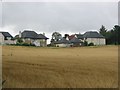
Pilmuir
Once a house or farm called Pilmuir stood here. The area is still farmed, but expensive new houses in Balerno are spreading. Very much urban fringe agriculture. The houses have an uninterrupted view to the north.
Image: © Richard Webb
Taken: 4 Aug 2005
0.16 miles
2
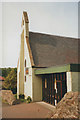
St Mungo's church, Balerno
An Episcopalian church. Website: http://www.stmungos.org/
Image: © Stephen Craven
Taken: 12 Jul 1996
0.21 miles
3
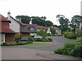
Ravelrig Park
Former parkland above Balerno is being converted into expensive housing. Here is a recently built up area.
Image: © Richard Webb
Taken: 4 Aug 2005
0.22 miles
4
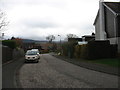
Ravelrig Park, Balerno
A relatively new housing development on the outskirts of Balerno, about 8 miles from Edinburgh along the A70.
Image: © David Purchase
Taken: 25 Oct 2018
0.24 miles
5
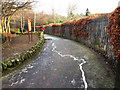
Start of the Water of Leith Walkway
The path leaves Balerno next to the school. The metal strip set into the pathway symbolises the river between here and Leith.
Image: © John Allan
Taken: 9 Jan 2018
0.25 miles