
IMAGES TAKEN NEAR TO
Ravelrig Road, BALERNO, EH14 7DG
Introduction
This page details the photographs taken nearby to Ravelrig Road, EH14 7DG by members of the Geograph project.
The Geograph project started in 2005 with the aim of publishing, organising and preserving representative images for every square kilometre of Great Britain, Ireland and the Isle of Man.

There are currently over 7.5m images from over14,400 individuals and you can help contribute to the project by visiting https://www.geograph.org.uk
Image Map
Images are licensed for reuse under creativecommons.org/licenses/by-sa/2.0
Notes
- Clicking on the map will re-center to the selected point.
- The higher the marker number, the further away the image location is from the centre of the postcode.
Image Listing (3 Images Found)
Images are licensed for reuse under creativecommons.org/licenses/by-sa/2.0
Image
Details
Distance
1
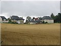
Pilmuir
Once a house or farm called Pilmuir stood here. The area is still farmed, but expensive new houses in Balerno are spreading. Very much urban fringe agriculture. The houses have an uninterrupted view to the north.
Image: © Richard Webb
Taken: 4 Aug 2005
0.10 miles
2
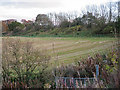
Former Railway
The embankment at the top of this field is the remains of a railway that served Balrno and Colinton on a loop from the main Caledonian Railway. Much of the trackbed, but not this bit, is now incorporated into the Water of Leith Walkway.
Image: © Anne Burgess
Taken: 2 Nov 2017
0.20 miles
3
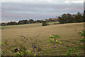
Fields near Ravelrig Road
In the distance are houses on the outskirts of Balerno.
Image: © Anne Burgess
Taken: 2 Nov 2017
0.23 miles