
IMAGES TAKEN NEAR TO
CURRIE, EH14 6AT
Introduction
This page details the photographs taken nearby to EH14 6AT by members of the Geograph project.
The Geograph project started in 2005 with the aim of publishing, organising and preserving representative images for every square kilometre of Great Britain, Ireland and the Isle of Man.

There are currently over 7.5m images from over14,400 individuals and you can help contribute to the project by visiting https://www.geograph.org.uk
Image Map
Images are licensed for reuse under creativecommons.org/licenses/by-sa/2.0
Notes
- Clicking on the map will re-center to the selected point.
- The higher the marker number, the further away the image location is from the centre of the postcode.
Image Listing (16 Images Found)
Images are licensed for reuse under creativecommons.org/licenses/by-sa/2.0
Image
Details
Distance
1

Wester Kinleith Farm
On Harlaw Road, a minor road that links the farms of Easter Kinleith, Middle Kinleith, Wester Kinleith and Harlaw on the southern slopes of the Water of Leith valley.
Image: © michael ely
Taken: 26 Feb 2011
0.01 miles
2

Cottages and winter barley at Wester Kinleith
Image: © M J Richardson
Taken: 1 Jan 2009
0.05 miles
3

Wester Kinleith
The farm buildings, and an array of horse boxes parked beside the Harlaw road.
Image: © Anne Burgess
Taken: 21 Apr 2016
0.06 miles
4

Harlaw Road
Harlaw Road looking east to its junction with Kirkgate, which starts at the white building. Rural scene, quiet road Birch tree in the Hawthorn hedge.
Image: © Adam Ward
Taken: 18 Jun 2016
0.09 miles
5

House, Kinleith
On a crossroads in an area popular with cyclists.
Image: © Richard Webb
Taken: 8 Jun 2005
0.09 miles
6

No through road, except for cyclists and walkers
The view of the minor road which can be used by cyclists and walkers heading for Torphin or Clubbiedean Reservoir
Image: © Sandy Gemmill
Taken: 5 Jun 2009
0.15 miles

8

Track junction, Kinleith
Junction at the top of Kirkgate above Currie. The signpost reads 'Torphin and Bonaly' which is along the minor road to Clubbiedean Reservoir; the track to the left meets the path from Harlaw to Glencorse.
Image: © Jim Barton
Taken: 23 Jun 2015
0.18 miles
9

Road closed, Kinleith
I wonder why? A beech tree down on the normally only open to non motorised traffic section of the Kirkgate. The road joins another track at the Maiden Cleuch crossing of the Pentland Hills.
Image: © Richard Webb
Taken: 31 Jan 2016
0.19 miles
10
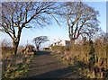
The old smiddy, Kinleith
The white house was once a smiddy (smithy) where a blacksmith operated.
Image: © Alan O'Dowd
Taken: 19 Dec 2018
0.19 miles