
IMAGES TAKEN NEAR TO
Lucas Gardens, JUNIPER GREEN, EH14 5BY
Introduction
This page details the photographs taken nearby to Lucas Gardens, EH14 5BY by members of the Geograph project.
The Geograph project started in 2005 with the aim of publishing, organising and preserving representative images for every square kilometre of Great Britain, Ireland and the Isle of Man.

There are currently over 7.5m images from over14,400 individuals and you can help contribute to the project by visiting https://www.geograph.org.uk
Image Map
Images are licensed for reuse under creativecommons.org/licenses/by-sa/2.0
Notes
- Clicking on the map will re-center to the selected point.
- The higher the marker number, the further away the image location is from the centre of the postcode.
Image Listing (32 Images Found)
Images are licensed for reuse under creativecommons.org/licenses/by-sa/2.0
Image
Details
Distance
1
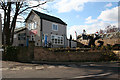
Juniper Green Village Hall
The east end looks like a tall narrow house. Note the sculpture of the letters JG to the right. The hall was originally a drill hall. See https://canmore.org.uk/site/333982/juniper-green-drill-hall and http://junipergreenvillagehall.co.uk/about/ for more information.
Image: © Anne Burgess
Taken: 20 Mar 2016
0.04 miles
2
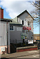
Juniper Green Village Hall
The east end, with a curious little tower-like building on the end. The hall was originally a drill hall. See https://canmore.org.uk/site/333982/juniper-green-drill-hall and http://junipergreenvillagehall.co.uk/about/ for more information.
Image: © Anne Burgess
Taken: 20 Mar 2016
0.05 miles
3
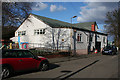
Juniper Green Village Hall
The main elevation of the building. The hall was originally a drill hall. See https://canmore.org.uk/site/333982/juniper-green-drill-hall and http://junipergreenvillagehall.co.uk/about/ for more information.
Image: © Anne Burgess
Taken: 20 Mar 2016
0.05 miles
4
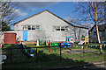
Juniper Green Village Hall
The west elevation, with a colourful children's playground outside it. The hall was originally a drill hall. See https://canmore.org.uk/site/333982/juniper-green-drill-hall and http://junipergreenvillagehall.co.uk/about/ for more information.
Image: © Anne Burgess
Taken: 20 Mar 2016
0.05 miles

6
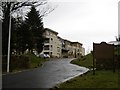
New flats, Baberton Avenue
View out of the golf club car park.
Image: © Richard Webb
Taken: 31 Jan 2016
0.10 miles
7

Belmont Road
One of the 19th century houses in Belmont Road.
Image: © Anne Burgess
Taken: 17 Apr 2016
0.10 miles
8

Woodhall Drive
Looking south towards the main A70 Lanark Road, with Torphin Quarry and the Pentland Hills beyond.
Image: © M J Richardson
Taken: 25 Aug 2008
0.11 miles
9

Kinleith Arms
Located on the Lanark Road in Edinburgh's Juniper Green suburb, beside a branch of the Iceland food store chain.
Image: © Mary and Angus Hogg
Taken: 22 Sep 2013
0.11 miles
10

The main road at Juniper Green
In Edinburgh.
Image: © James Denham
Taken: 10 Apr 2009
0.13 miles