
IMAGES TAKEN NEAR TO
Baberton Crescent, JUNIPER GREEN, EH14 5BW
Introduction
This page details the photographs taken nearby to Baberton Crescent, EH14 5BW by members of the Geograph project.
The Geograph project started in 2005 with the aim of publishing, organising and preserving representative images for every square kilometre of Great Britain, Ireland and the Isle of Man.

There are currently over 7.5m images from over14,400 individuals and you can help contribute to the project by visiting https://www.geograph.org.uk
Image Map
Images are licensed for reuse under creativecommons.org/licenses/by-sa/2.0
Notes
- Clicking on the map will re-center to the selected point.
- The higher the marker number, the further away the image location is from the centre of the postcode.
Image Listing (54 Images Found)
Images are licensed for reuse under creativecommons.org/licenses/by-sa/2.0
Image
Details
Distance
1
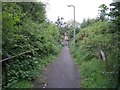
Path to Baberton
Handy footpath linking the Lanark Road with the Baberton housing estate.
Image: © Callum Black
Taken: 13 Sep 2008
0.09 miles
2
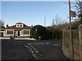
End of Woodhall Millbrae
The road on the right drops to the Water of Leith to the houses on the old mill site.
Image: © Richard Webb
Taken: 13 Nov 2022
0.10 miles
3

Baberton Crescent
Residential street to the west of the A720.
Image: © Barbara Carr
Taken: 4 Jul 2013
0.10 miles
4

The Lanark Road heading in to Juniper Green
In Edinburgh.
Image: © James Denham
Taken: 10 Apr 2009
0.10 miles
5

Juniper Green Church
An impressive building, located on the A70 route in suburban Edinburgh.
Image: © Mary and Angus Hogg
Taken: 22 Sep 2013
0.13 miles
6

Juniper Green Parish Church
Relatively recent - before the middle of the 19C Juniper Green had no church of its own, and folks had to walk to Colinton, about 1.5 km along the Water of Leith.
Image: © M J Richardson
Taken: 25 Aug 2008
0.13 miles
7
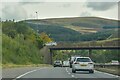
Juniper Green : City of Edinburgh Bypass A720
Looking along the City of Edinburgh Bypass A720.
Image: © Lewis Clarke
Taken: 23 Sep 2020
0.13 miles
8

Woodhall Millbrae
Serving houses by the Water of Leith. Nearby is the oldest stretch of the City Bypass. Previously it was the road down to Woodhall Mill
Image: © Richard Webb
Taken: 13 Nov 2022
0.14 miles
9
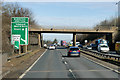
A720 City of Edinburgh Bypass, Lanark Road Bridge
Image: © David Dixon
Taken: 5 Mar 2020
0.15 miles
10

A70 bridge over the Edinburgh City Bypass (A720)
Image: © JThomas
Taken: 2 May 2014
0.15 miles