
IMAGES TAKEN NEAR TO
Slateford Green, EDINBURGH, EH14 1NF
Introduction
This page details the photographs taken nearby to Slateford Green, EH14 1NF by members of the Geograph project.
The Geograph project started in 2005 with the aim of publishing, organising and preserving representative images for every square kilometre of Great Britain, Ireland and the Isle of Man.

There are currently over 7.5m images from over14,400 individuals and you can help contribute to the project by visiting https://www.geograph.org.uk
Image Map
Images are licensed for reuse under creativecommons.org/licenses/by-sa/2.0
Notes
- Clicking on the map will re-center to the selected point.
- The higher the marker number, the further away the image location is from the centre of the postcode.
Image Listing (123 Images Found)
Images are licensed for reuse under creativecommons.org/licenses/by-sa/2.0
Image
Details
Distance
1

Slateford Green
A curved, "wall" development on the site of railway sidings at the long closed Gorgie Station.
Image: © Richard Webb
Taken: 8 Feb 2016
0.04 miles
2

Slateford Green Housing
Developed by Canmore Housing Association and designed by Hackland & Dore Architects. Completed in 2000.
Image: © Graeme Yuill
Taken: 20 Sep 2014
0.04 miles
3

Cycle and footpath at Slateford
Running along the track of an old railway. The tower block is Hutchison House Image
Image: © M J Richardson
Taken: 24 Apr 2017
0.08 miles
4

Flats, Slateford Gait
The redevelopment of a brewery site c.2007
Image: © Richard Webb
Taken: 8 Nov 2023
0.08 miles
5

Nil Wind Day
For about the last three days the wind has been light or non-existent. I think this is the steam from the brewery, going almost straight up on a Sunday morning. What price your wind turbines now, Eck? You will still need backup power generating capacity for 100% of maximum demand on days like this, and on days when the winds are too strong and the turbines have to be stopped - or get damaged.
(For the uninitiated, 'Eck' is a nickname for Scotland's First Minister Alec Salmond, whose government seems hellbent on subsidising big business to cover the entire country with wind turbines and power lines to provide 'green' energy.)
Image: © Anne Burgess
Taken: 15 Jan 2012
0.08 miles
6
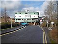
Gorgie Park Road
View towards the Slateford Green flats.
Image: © Richard Webb
Taken: 8 Feb 2016
0.08 miles
7

Disused car park and building off Gorgie Road
The area has been fenced off and most appears disused. The building is believed to be still operational as a BT exchange.
Image: © Robin Webster
Taken: 17 Sep 2019
0.09 miles
8

Flats on Slateford Gait
Built on the site of a brewery.
Image: © Richard Webb
Taken: 8 Nov 2023
0.09 miles
9

Slateford Gait/ Robertson Gait
Flats on a brewery site.
Image: © Richard Webb
Taken: 8 Nov 2023
0.09 miles
10

Slateford Green
Viewed from the railway bridge in Slateford Road.
See Image for more details about Slateford Green.
Image: © Thomas Nugent
Taken: 12 Aug 2012
0.09 miles