
IMAGES TAKEN NEAR TO
Colinton Mains Green, EDINBURGH, EH13 9AG
Introduction
This page details the photographs taken nearby to Colinton Mains Green, EH13 9AG by members of the Geograph project.
The Geograph project started in 2005 with the aim of publishing, organising and preserving representative images for every square kilometre of Great Britain, Ireland and the Isle of Man.

There are currently over 7.5m images from over14,400 individuals and you can help contribute to the project by visiting https://www.geograph.org.uk
Image Map
Images are licensed for reuse under creativecommons.org/licenses/by-sa/2.0
Notes
- Clicking on the map will re-center to the selected point.
- The higher the marker number, the further away the image location is from the centre of the postcode.
Image Listing (41 Images Found)
Images are licensed for reuse under creativecommons.org/licenses/by-sa/2.0
Image
Details
Distance
1
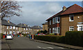
Colinton Housing
Suburban Edinburgh viewed on a fine early-spring afternoon.
Image: © Mary and Angus Hogg
Taken: 8 Mar 2017
0.04 miles
3
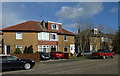
Colinton Mains Drive
Houses in suburban Edinburgh viewed on a fine early-spring afternoon.
Image: © Mary and Angus Hogg
Taken: 8 Mar 2017
0.06 miles

5

Braid Burn near Colinton Mains Drive, Edinburgh
The Braid Burn flows generally NE through the suburbs to reach the Firth of Forth at Portobello.
Image: © Jim Barton
Taken: 14 Sep 2017
0.08 miles
6
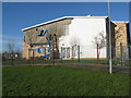
Dodgy gable at Oxgangs Primary School
A large area of the southeast gable's brick-facing came off on 29 Jan. during storm Gertrude, which was, therefore, blamed. One might question whether there could have been any fault in design or construction? The building is not all that new - it appears on Google Earth imagery of 2005. The school was closed for 2 days, but reopened on 3 February.
As a postscript, it was announced on 10 April 2016 that pupils from 17 Edinburgh schools would not be able to return after the Easter break as inspections had revealed defects in their structure. Schools built under the Private Finance Agreement by the same contractors have been found to have missing wall-ties. The schools are closed indefinitely. http://www.geograph.org.uk/photo/4903902
Image: © M J Richardson
Taken: 3 Feb 2016
0.08 miles
7

Back to school
Pupils returned to Oxgangs primary School on 24 May, when repair work to the gable was almost complete, after about 6 weeks closure http://www.geograph.org.uk/photo/4903902. Some schools are still closed.
Image: © M J Richardson
Taken: 25 May 2016
0.08 miles
8

Allermuir Health Centre
Completed in Autumn 2017 and designed by Hoskins Architects
Image: © Graeme Yuill
Taken: 29 Apr 2018
0.09 miles

10

Allermuir Health Centre
Completed in Autumn 2017 and designed by Hoskins Architects.
Image: © Graeme Yuill
Taken: 12 Nov 2017
0.09 miles