
IMAGES TAKEN NEAR TO
Capelaw Road, EDINBURGH, EH13 0HG
Introduction
This page details the photographs taken nearby to Capelaw Road, EH13 0HG by members of the Geograph project.
The Geograph project started in 2005 with the aim of publishing, organising and preserving representative images for every square kilometre of Great Britain, Ireland and the Isle of Man.

There are currently over 7.5m images from over14,400 individuals and you can help contribute to the project by visiting https://www.geograph.org.uk
Image Map
Images are licensed for reuse under creativecommons.org/licenses/by-sa/2.0
Notes
- Clicking on the map will re-center to the selected point.
- The higher the marker number, the further away the image location is from the centre of the postcode.
Image Listing (41 Images Found)
Images are licensed for reuse under creativecommons.org/licenses/by-sa/2.0
Image
Details
Distance
1

Capelaw Road
Above Colinton. The "helpful" sign is an attempt to prevent getting around the road closure on Bonaly Road.
Image: © Richard Webb
Taken: 1 Aug 2024
0.03 miles
3

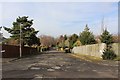
Allermuir Road
When you close a road (Bonaly Road in this case) remember to put up go away notices on all the alternatives.
Image: © Richard Webb
Taken: 1 Aug 2024
0.04 miles
4
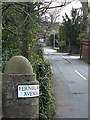
Fernielaw Avenue, Colinton
An affluent suburb at the southern edge of Edinburgh's city limits. Fernielaw Avenue climbs south from Woodhall Road.
Image: © michael ely
Taken: 17 Apr 2008
0.05 miles
5

Woodfield Park Woods
Once the policies of a big house, Woodfield. Much of this land is now housing.
Image: © Richard Webb
Taken: 1 Aug 2024
0.06 miles


8

West Carnethy Avenue
Suburban road with rough surface below Fernielaw.
Image: © Richard Webb
Taken: 1 Aug 2024
0.08 miles
9

West Mill Road
There were paper and corn mills on the Water of Leith below here. The site is now occupied by flats.
Image: © Richard Webb
Taken: 1 Aug 2024
0.08 miles
10

Woodhall Road
Above West Mills, towards the Colinton end of the road.
Image: © Richard Webb
Taken: 1 Aug 2024
0.10 miles