
IMAGES TAKEN NEAR TO
Forrester Park Avenue, EDINBURGH, EH12 9AW
Introduction
This page details the photographs taken nearby to Forrester Park Avenue, EH12 9AW by members of the Geograph project.
The Geograph project started in 2005 with the aim of publishing, organising and preserving representative images for every square kilometre of Great Britain, Ireland and the Isle of Man.

There are currently over 7.5m images from over14,400 individuals and you can help contribute to the project by visiting https://www.geograph.org.uk
Image Map
Images are licensed for reuse under creativecommons.org/licenses/by-sa/2.0
Notes
- Clicking on the map will re-center to the selected point.
- The higher the marker number, the further away the image location is from the centre of the postcode.
Image Listing (42 Images Found)
Images are licensed for reuse under creativecommons.org/licenses/by-sa/2.0
Image
Details
Distance
1
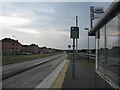
Saughton Halt West
Looking west along the guided busway from one of the bus stops. The busway is a dedicated road for buses, and is presumably intended to be part of an efficient and integrated transport system that we will have in Edinburgh sometime in the future. The electronic bus information display indicated that no information was available.
Image: © M J Richardson
Taken: 31 Jul 2008
0.06 miles
2
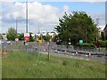
Roadworks, Broomhouse
Another road closure, maybe tram related as there is a works entrance here. The tramline is to the left.
Image: © Richard Webb
Taken: 12 Jun 2013
0.07 miles
3
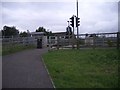
Guided busway station
The Edinburgh public cannot be trusted to cross the busway all by themselves so a pedestrian crossing is provided. How they manage in other countries, I can't imagine.
Image: © Callum Black
Taken: 13 Sep 2008
0.08 miles
4
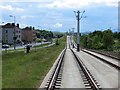
Tram line, Broomhouse Drive
Started life as a guided busway. The cables have yet to go up. Only half a route was built due to a long list of mistakes, mismanagement and a bit of bad luck. Building out here was almost painless, the problems happened in town with the expense and difficulty of rerouting all the understreet utilities.
Image: © Richard Webb
Taken: 12 Jun 2013
0.08 miles
5
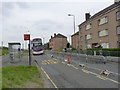
Broomhouse Drive
Currently restricted to westbound traffic only. This has nothing to do with the adjacent tramway construction, but is due to comprehensive rebuilding and resurfacing. The eastbound bus stop is flagged as out of use.
Image: © Alan Murray-Rust
Taken: 11 Jun 2013
0.08 miles
6
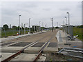
Saughton tramstop
On the site of the former guided busway. Construction is well advanced although there is still much to do.
Image: © Alan Murray-Rust
Taken: 11 Jun 2013
0.11 miles
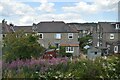
8
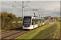
Tram leaving Saughton
Edinburgh Castle rises in the distance.
Image: © Alan Murray-Rust
Taken: 9 Oct 2017
0.13 miles
9
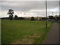
Saughton House
Government Offices, home to HM Inspectorate of Education.
A large swathe of green space has been left next to the railway line in this western part of Edinburgh. This has made it the ideal choice of route for Edinburgh's still to be constructed tram system.
The cycle route, hugging the road, could have been made so much better with bridges over the north-south running roads, rather than the awkward pedestrian shared crossings and inevitable "cyclists dismount" signs.
Image: © Callum Black
Taken: 13 Sep 2008
0.14 miles
10
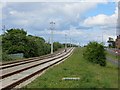
Tram line, Broomhouse Drive
The tracks are down but the cables have yet to be put up. This is part of what was to be a three line network but will in reality just be half a route from the city centre to the airport.
The trackbed had a previous life as a guided busway. Image
Image: © Richard Webb
Taken: 12 Jun 2013
0.15 miles