
IMAGES TAKEN NEAR TO
Moreland View, EDINBURGH, EH12 8NS
Introduction
This page details the photographs taken nearby to Moreland View, EH12 8NS by members of the Geograph project.
The Geograph project started in 2005 with the aim of publishing, organising and preserving representative images for every square kilometre of Great Britain, Ireland and the Isle of Man.

There are currently over 7.5m images from over14,400 individuals and you can help contribute to the project by visiting https://www.geograph.org.uk
Image Map
Images are licensed for reuse under creativecommons.org/licenses/by-sa/2.0
Notes
- Clicking on the map will re-center to the selected point.
- The higher the marker number, the further away the image location is from the centre of the postcode.
Image Listing (30 Images Found)
Images are licensed for reuse under creativecommons.org/licenses/by-sa/2.0
Image
Details
Distance
1

Moreland View
I don't often remember seeing whole blocks being built to let, but the board on the perimeter of this block says specifically that these are apartments for mid-market rent. Whatever that means.
Image: © Anne Burgess
Taken: 5 Dec 2012
0.02 miles
2

Craigs Road
Modern flats, and slightly more traditional-style houses, line the north side of Craigs Road. They used to have a view of Craigmount Academy, but it has been replaced by a new building a little further east, and the school site has been redeveloped for housing.
Image: © Anne Burgess
Taken: 5 Dec 2012
0.05 miles
3

East Craigs
The view of the foot path on the southern side of Craigs Road, with new housing on the left and construction work on the right.
Image: © Sandy Gemmill
Taken: 27 Sep 2008
0.07 miles
4
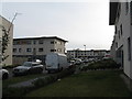
Burnbrae Drive at East Craigs
Part of a large residential development on the site of what was government agricultural and plant health laboratories and plant breeding station. Under various names they had been there since 1925. The farmland was rezoned for housing and new laboratories were built and occupied at Gogarbank in 2006 Image The East Craigs laboratories were demolished and replaced with houses.
Image: © M J Richardson
Taken: 11 Nov 2012
0.09 miles
5

Craigs Road
Relatively new housing on what was the land of a Scottish Office experimental farm [Scottish Agricultural Scientific Services].
Image: © M J Richardson
Taken: 7 Jul 2008
0.11 miles
6

New Housing at Burnbrae
Some of the new housing developments on the west side of Edinburgh.
Image: © Anne Burgess
Taken: 26 Sep 2021
0.13 miles
7
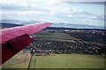
East Craigs, Corstorphine in 1971
Taken from a plane on its way into Turnhouse [now Edinburgh International Airport], approaching to Runway 30, now rarely used by passenger traffic. The green foreground is still there, but the fields in the middle distance are all now built upon. At the time of the photo they were part of the land of the Scottish Office Agricultural Scientific Services, now moved to a new site - see Image The 'new' Craigmount school, visible between flap and aileron, has been demolished and rebuilt in the playing field, to the right.
Image: © M J Richardson
Taken: 21 Jul 1971
0.15 miles
8

East Craigs House
The house on Burnbrae Drive, fitting into the landscape four years or so after its restoration Image
Image: © M J Richardson
Taken: 22 Jun 2016
0.15 miles
9
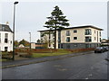
New houses at East Craigs
One block on Burnbrae Drive, part of a large residential development on the site of what was government agricultural and plant health laboratories and plant breeding station. Under various names they had been there since 1925. The farmland was rezoned for housing and new laboratories were built and occupied at Gogarbank in 2006 Image The East Craigs laboratories were demolished and replaced with houses. The house to the left is East Craigs House- see Image
Image: © M J Richardson
Taken: 11 Nov 2012
0.16 miles
10

4a, 4b and 4c Burnbrae Drive
Category C Listed building with later additions, including the semi-octagonal tower at the front. See http://portal.historicenvironment.scot/designation/LB28069 for more information.
Image: © Anne Burgess
Taken: 26 Sep 2021
0.16 miles