
IMAGES TAKEN NEAR TO
Wester Broom Avenue, EDINBURGH, EH12 7QU
Introduction
This page details the photographs taken nearby to Wester Broom Avenue, EH12 7QU by members of the Geograph project.
The Geograph project started in 2005 with the aim of publishing, organising and preserving representative images for every square kilometre of Great Britain, Ireland and the Isle of Man.

There are currently over 7.5m images from over14,400 individuals and you can help contribute to the project by visiting https://www.geograph.org.uk
Image Map
Images are licensed for reuse under creativecommons.org/licenses/by-sa/2.0
Notes
- Clicking on the map will re-center to the selected point.
- The higher the marker number, the further away the image location is from the centre of the postcode.
Image Listing (22 Images Found)
Images are licensed for reuse under creativecommons.org/licenses/by-sa/2.0
Image
Details
Distance

2
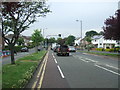
Meadow Place Road (B701)
Looking north west.
Image: © JThomas
Taken: 21 Jun 2017
0.09 miles
4
Building speed humps, Corstorphine.
Edinburgh is home to a lot of speed humps, and they are multiplying. While proven effective in lowering speeds in residential areas, they are a pain when out on the bike. Some studies suggest that road humps are the only effective way of enforcing a 20mph/30kph speed limit. Residential area just off the busy main shopping street of Corstorphine.
Image: © Richard Webb
Taken: 8 Jun 2005
0.16 miles
5
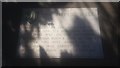
The Physic Well of Corstorphine
"The Physic Well.
"Much Prized in the eighteenth century for its medicinal water. This well was on the southside of the Stank Burn & some 40 yards east of this spot where its well head was rebuilt in 1972 when the burn was culverted."
This is one of Corstorphine's two lost wells, the other being the Lady Well, which gives its name to some of the streets nearby. The two are frequently confused. Corstorphine may in fact derive its name from these wells - see the book "Literary Corstorphine".
This site is at the back of Dunsmuir Court, and is well hidden. Dunsmuir Court is social housing, but there used to be a mansion house near here. The well is not signposted from the main road.
"Stank" is an old Scots word for a ditch (Gaelic: staing), and was applied to the burn which formerly flowed across here, and connected the Gogar Loch to Corstorphine Loch.
Image: © Raymond Bell
Taken: 24 Aug 2018
0.17 miles



9
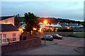
Gylemuir School Seen From South Gyle Gardens
Image: © William Grierson
Taken: 6 Jun 2005
0.21 miles
10

Gylemuir Primary School
Last day of the Christmas/New Year holiday.
Image: © Richard Webb
Taken: 3 Jan 2023
0.21 miles