
IMAGES TAKEN NEAR TO
Belmont Gardens, EDINBURGH, EH12 6JD
Introduction
This page details the photographs taken nearby to Belmont Gardens, EH12 6JD by members of the Geograph project.
The Geograph project started in 2005 with the aim of publishing, organising and preserving representative images for every square kilometre of Great Britain, Ireland and the Isle of Man.

There are currently over 7.5m images from over14,400 individuals and you can help contribute to the project by visiting https://www.geograph.org.uk
Image Map
Images are licensed for reuse under creativecommons.org/licenses/by-sa/2.0
Notes
- Clicking on the map will re-center to the selected point.
- The higher the marker number, the further away the image location is from the centre of the postcode.
Image Listing (50 Images Found)
Images are licensed for reuse under creativecommons.org/licenses/by-sa/2.0
Image
Details
Distance
1
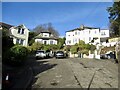
Belmont Gardens
A steep residential road on the south side of Corstorphine Hill.
Image: © Richard Webb
Taken: 31 Jan 2022
0.02 miles
2
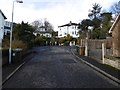
Belmont Gardens
End of a residential cup-de-sac.
Image: © Richard Webb
Taken: 8 Feb 2016
0.03 miles
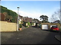
4
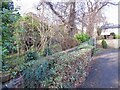
Beechwood Mains
A steep residential road on the south side of Corstorphine Hill.
Image: © Richard Webb
Taken: 31 Jan 2022
0.09 miles
5
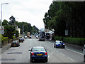
Western Terrace (A8), Murrayfield
Before reaching the city centre, the road passes through the suburbs of Edinburgh past the affluent areas of Corstorphine and Murrayfield, often with an accompanying bus lane.
Image: © David Dixon
Taken: 3 Aug 2019
0.10 miles
6

Corstorphine Road
Western Manor House Hotel at the junction of Belmont Road.
Image: © Thomas Nugent
Taken: 22 Jul 2012
0.10 miles
7
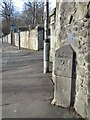
Milestone, Corstorphine
2 miles out from Edinburgh on the road to Glasgow, now the A8.
Image: © Richard Webb
Taken: 31 Jan 2022
0.11 miles
8

Old Milestone by the A8, Corstorphine Road, Murrayfield
By the A8, in parish of Corstorphine (City Of Edinburgh District), Corstorphine Road, just East of Beechwood Mains, Murrayfield, against wall, back of footpath.
Inscription reads:-
: GLASGOW / 40 / MILES : : EDINBURGH / 2 / MILES :
Grade C(S) Listed. Reference: LB48885
http://portal.historicenvironment.scot/designation/LB48885
Surveyed
Milestone Society National ID: CE_EDGW02.
Image: © Milestone Society
Taken: Unknown
0.11 miles
9

Old milestone
A view of the right-hand face of the stone on Corstorphine Road, Murrayfield. The left-hand face is inscribed Glasgow/40/MILES. It is thought that the small holes are where a cover was fixed in 1940 instead of erasing the legends. A sensitive repair is to be made to the chipped area at the top of the front edge.
Image: © Chris Minto
Taken: 13 Aug 2020
0.11 miles
10

Old milestone plaque
The plaque that has been set up above the second milestone out of Edinburgh on the A8, Corstorphine Road, Murrayfield.
Image: © John Riddell
Taken: 15 Aug 2021
0.11 miles