
IMAGES TAKEN NEAR TO
Roseburn Street, EDINBURGH, EH12 5NW
Introduction
This page details the photographs taken nearby to Roseburn Street, EH12 5NW by members of the Geograph project.
The Geograph project started in 2005 with the aim of publishing, organising and preserving representative images for every square kilometre of Great Britain, Ireland and the Isle of Man.

There are currently over 7.5m images from over14,400 individuals and you can help contribute to the project by visiting https://www.geograph.org.uk
Image Map
Images are licensed for reuse under creativecommons.org/licenses/by-sa/2.0
Notes
- Clicking on the map will re-center to the selected point.
- The higher the marker number, the further away the image location is from the centre of the postcode.
Image Listing (311 Images Found)
Images are licensed for reuse under creativecommons.org/licenses/by-sa/2.0
Image
Details
Distance
1

Roseburn Street
The Roseburn Lounge is on the corner with Roseburn Terrace, the pub is stowed out on match days at Murrayfield.
Image: © Richard Webb
Taken: 8 Feb 2016
0.00 miles

3

Roseburn Lounge
Looking along Russell Road to the pub which is very busy on Murrayfield match days.
Image: © Richard Webb
Taken: 8 Feb 2016
0.01 miles
4

The Roseburn Bar
A favourite haunt of the rugby fraternity on match days at nearbu Murrayfield stadium. Within a Category C Listed building http://data.historic-scotland.gov.uk/pls/htmldb/f?p=2200:15:0::::BUILDING:48914 .
Image: © Thomas Nugent
Taken: 24 Jun 2013
0.02 miles

6
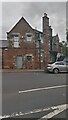
Corner Building Situated on Three Streets
The southern end of this higgledy-piggledy building is pictured. It sits on the corner of Roseneath Street (one of the numerous named sections of the A8 - the main route into the capital from the west), Roseneath Terrace, and Russell Road. Historic Scotland describe the building as merely being 'asymmetrical' - this is something of an understatement. While only dating from the 1890s, due to its quirkiness and prominent position on the main road it has listed building status.
It was originally a coach house and stables with the upper levels used for storage and accommodation. The bulk of the building is to the left of shot, and the bottom floor is currently a small Tesco supermarket. Previous to this it was a car showroom, and there is an arched window, immediately to the left of the picture, that may or may not have had something to do with this - it was the original entrance for the coaches and horses.
It was built for Robert Usher, who was about halfway down the family-tree of a dynasty that made its money in the alcohol trade. The company, which usually had 'Usher' in its name somewhere, made most of its fortune by blending whisky, and is said to be responsible for introducing 'Scotch' to England. Until the 1880s brandy was the main spirit drunk south of the Border; whisky, until this point, was rarely drunk very far from where it was made. The family was so wealthy in fact, that they were able to donate vast sums of money, Carnegie-style, to good causes. The Usher Hall, Edinburgh's main high-end concert venue, used predominantly for classical music, was the result of one such donation.
The old coach house is only half a mile from the North British Distillery Company's complex at the West end of Gorgie, a suburb of Edinburgh, so there may be a link there. This distillery is still working, and the only one that remains in the city. It is now owned by Diageo, like pretty much everything else alcohol-related, but seems to have only changed hands in the 1990s. It was built by Robert Usher's father, to provide the grain whisky that always gets mixed with the more esteemed malt whisky in blended whisky.
I couldn't decide whether the top floor on this side of the building is currently occupied by a business or residents, but there is a letterbox with a number 3 on the door at the top of the metal steps. The listed building write-up describes the tall chimney stack to the left of the door as being 'battered'. This means that its sides are facing in the way, sloping away a little from the vertical, though if so it doesn't seem very pronounced. They also describe chimney pots as cans, which seems very low-brow compared to their usual terminology!
Image: © Ian Dodds
Taken: 7 Aug 2021
0.02 miles
7

Roseburn Place
A quieter residential street with traditional tenement blocks.
Image: © Bill Boaden
Taken: 12 Oct 2013
0.02 miles
8

Kew and Roseburn Terraces
Kew Terrace to the junction, then Roseburn Terrace, from the former Caledonian Railway Bridge that carries the Roseburn Path and cycleway over the A8.
Image: © M J Richardson
Taken: 27 Mar 2008
0.03 miles
9

Russell Road
The north end of Russell Road at Roseburn Street.
Image: © Thomas Nugent
Taken: 22 Jul 2012
0.03 miles
10

Roseburn Terrace
The A8 road at the junction with Roseburn Street.
Image: © Thomas Nugent
Taken: 2 Jun 2014
0.03 miles